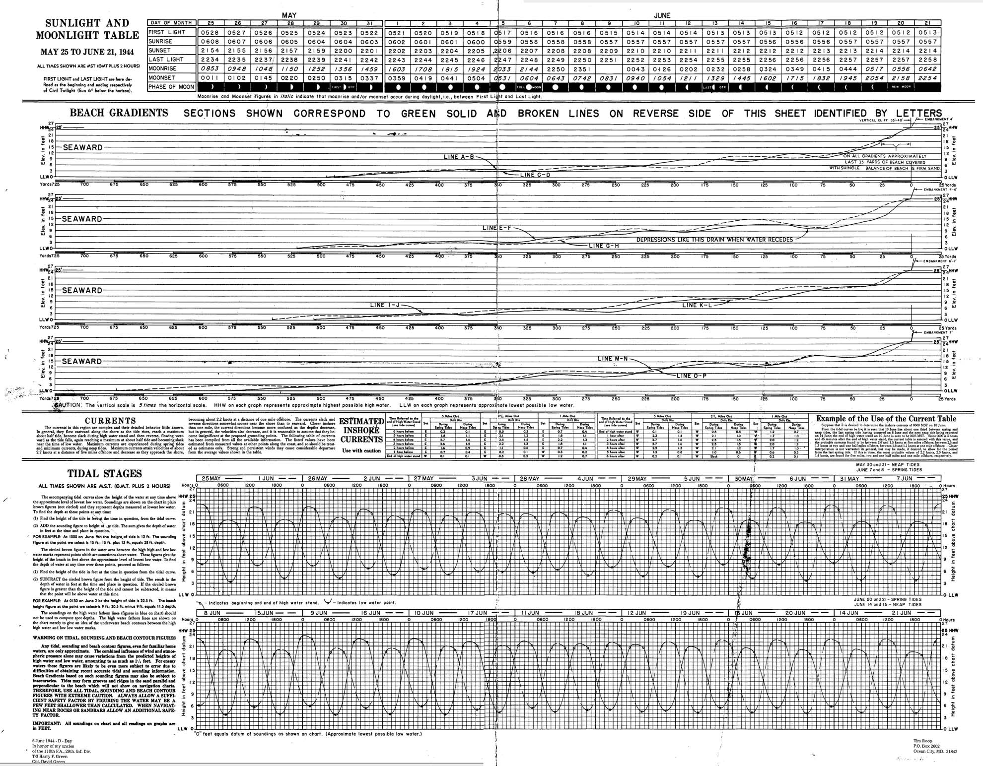
Complete with relief photos and elevation tables, the actual maps from the Normandy Invasion still inspire awe.
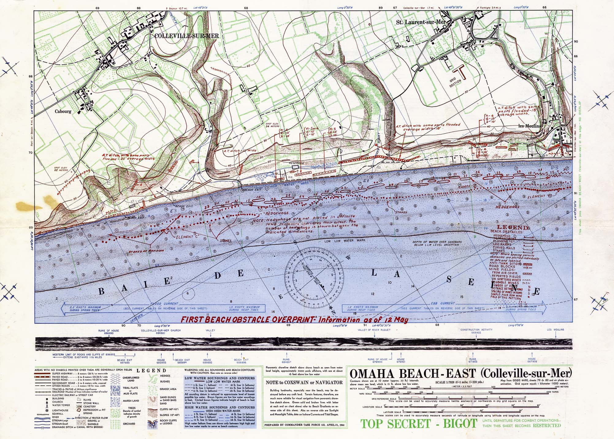
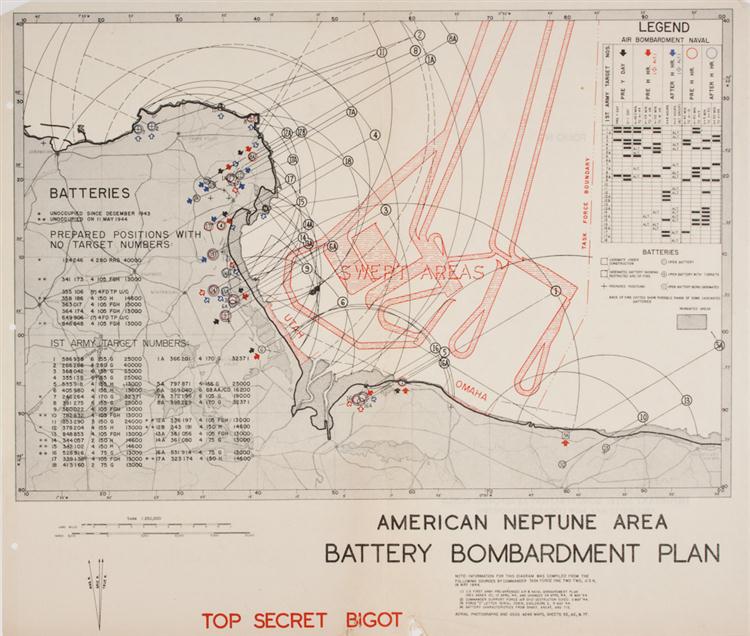
Classified as “Bigot,” the highest top secret security level possible, a very few persons even knew of the existence of this and other maps prepared for the assault on Hitler’s Fortress Europe.
Half of Omaha Beach
Source: Wikipedia
June Gloom and a Full Moon
June has come with gloom under low, unseasonably cool skies over New York City, mirroring the climate in Northwest Europe at the opening of the most monumental June in human history. [Now June 6, 2017, and it is 56 degrees and with a intermittent sea mist rain that makes this 73rd anniversary’s weather all the more like the 6th of June in Normandy in 1944, than when this was originally posted in 2015.]
The weather was so bad in the spring of 1944 that D-Day was postponed at the last minute, for 24 hours. So the first courageous airborne troops dropped from the sky a few minutes after midnight on June 6, to begin operations prior to the full scale assault that slammed into five beaches, as dawn lit the Normandy coastline west of Caen.
These maps give some indication of the enormity of the invasion, and the amount of detailed planning that went into it.
Some are taken from painstaking copies of original Bigot maps created for the D-Day landings, and available for sale at Alan Godfrey Reproductions.
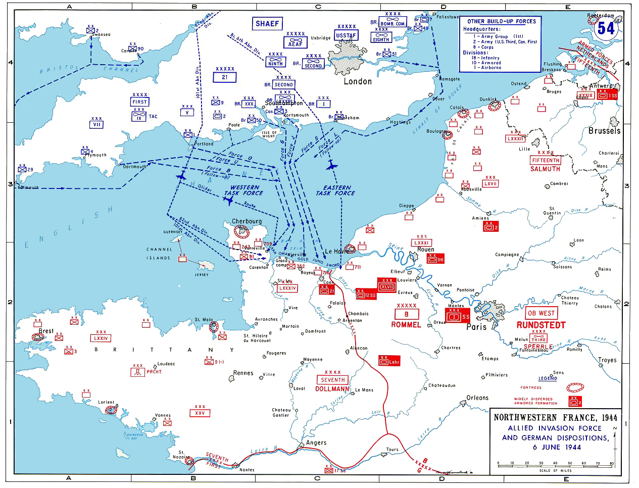
The Full Invasion Area
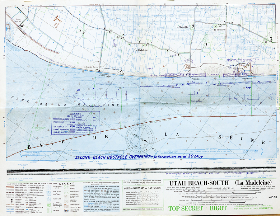
Half of Utah Beach
American Naval Operations (Operation Neptune)
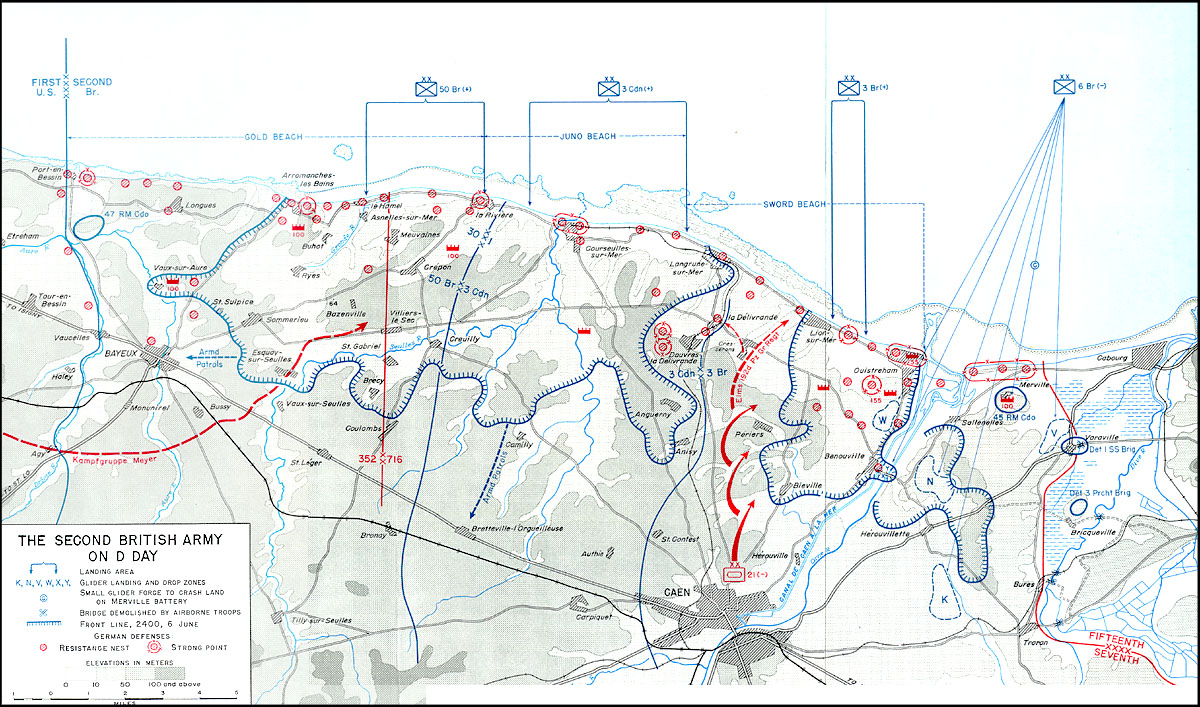
British Empire Operations
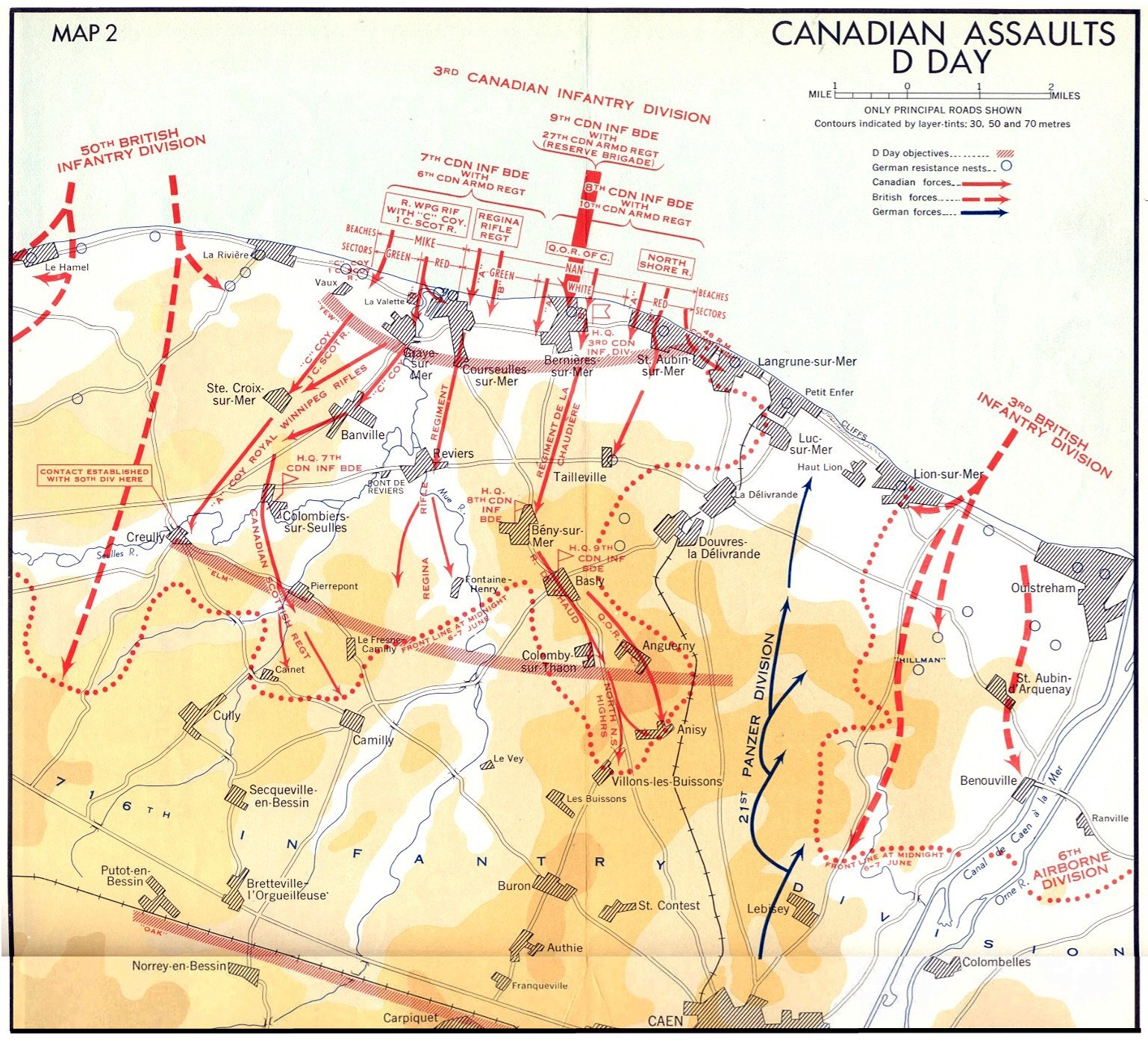
Canadian Assault on Juno Beach
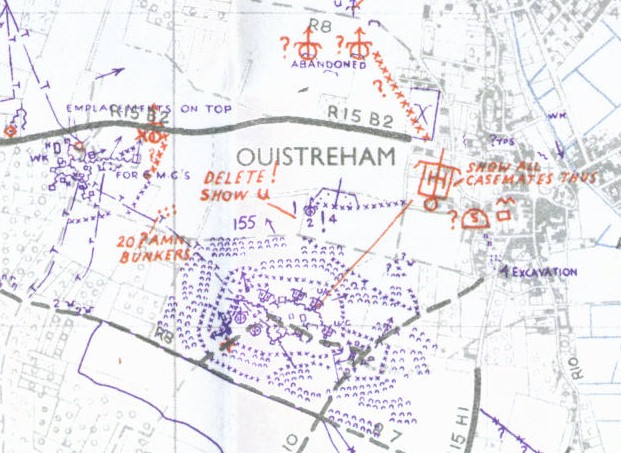
British Main Assault at Sword Beach
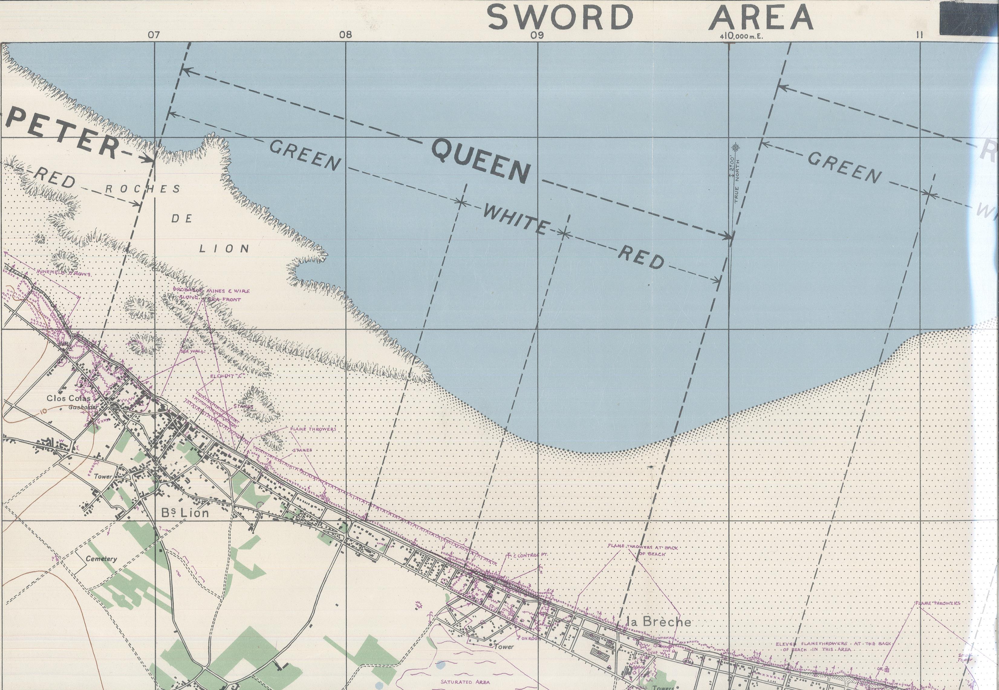
Detail from Bigot map of Sword Operations (English and Free French Commandos)
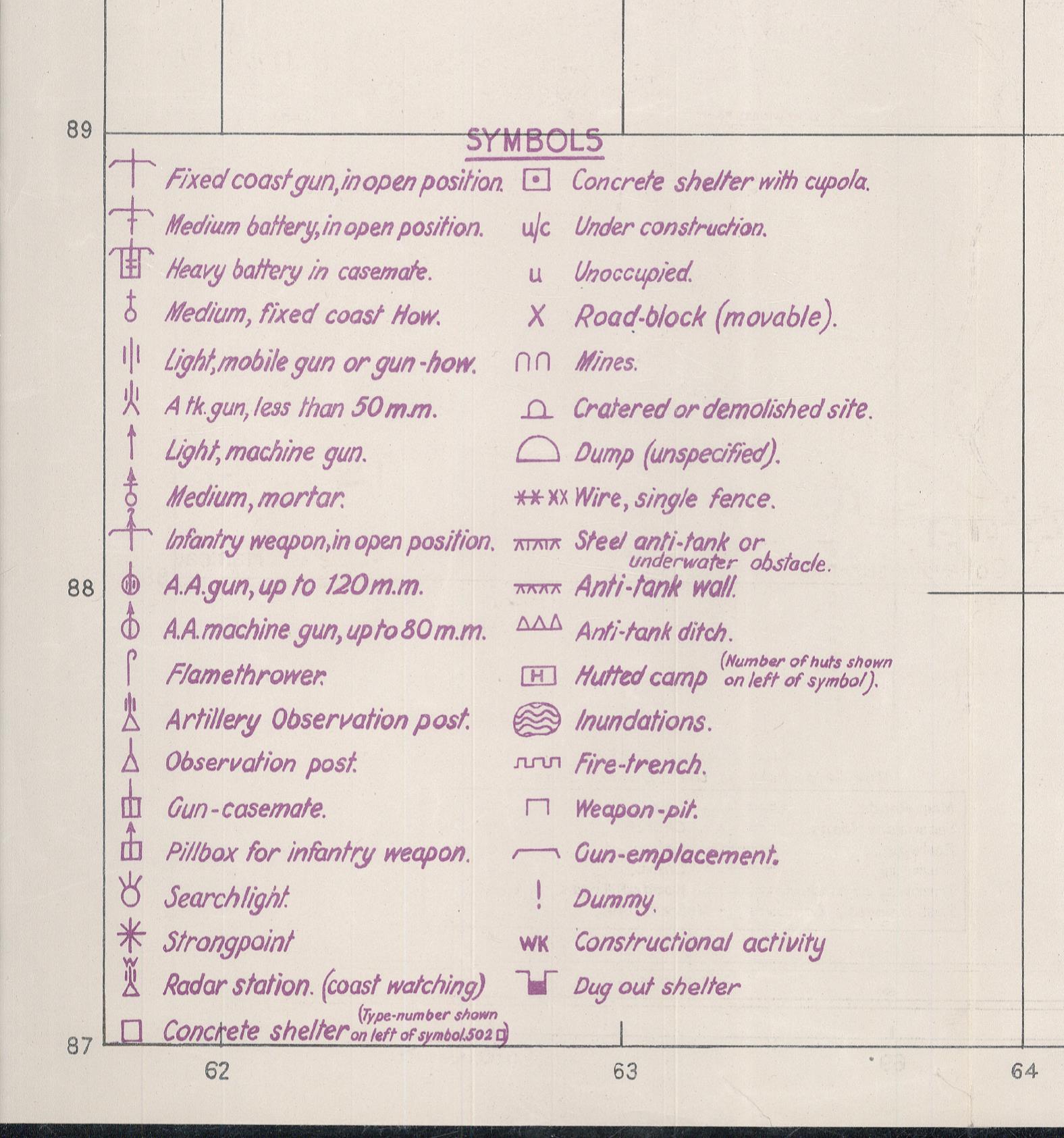
Detail of British Bigot Map Legends
Other Reading:
Britannica’s D-Day site was created years ago, so it has some bad links, but it is full of interesting oral histories by veterans, as well as detailed charts and maps, and other information of interest.
http://kids.britannica.com/dday/browse?browseId=237176
U.S. Army official report on the action at and around Omaha Beach, 6 June 1944. This was prepared and provided to veterans at the 50th Anniversary commemoration in 1994, and based closely on the official report by the War Department, 20 September 1945