Utah Beach in Rubber, 1944 – Monday Map

Amazing detail created out of Rubber for the D-Day Landings

Utah Beach down the individual house
Utah Beach rubber relief map 1944 D-Day oneman.com
(click to enlarge)

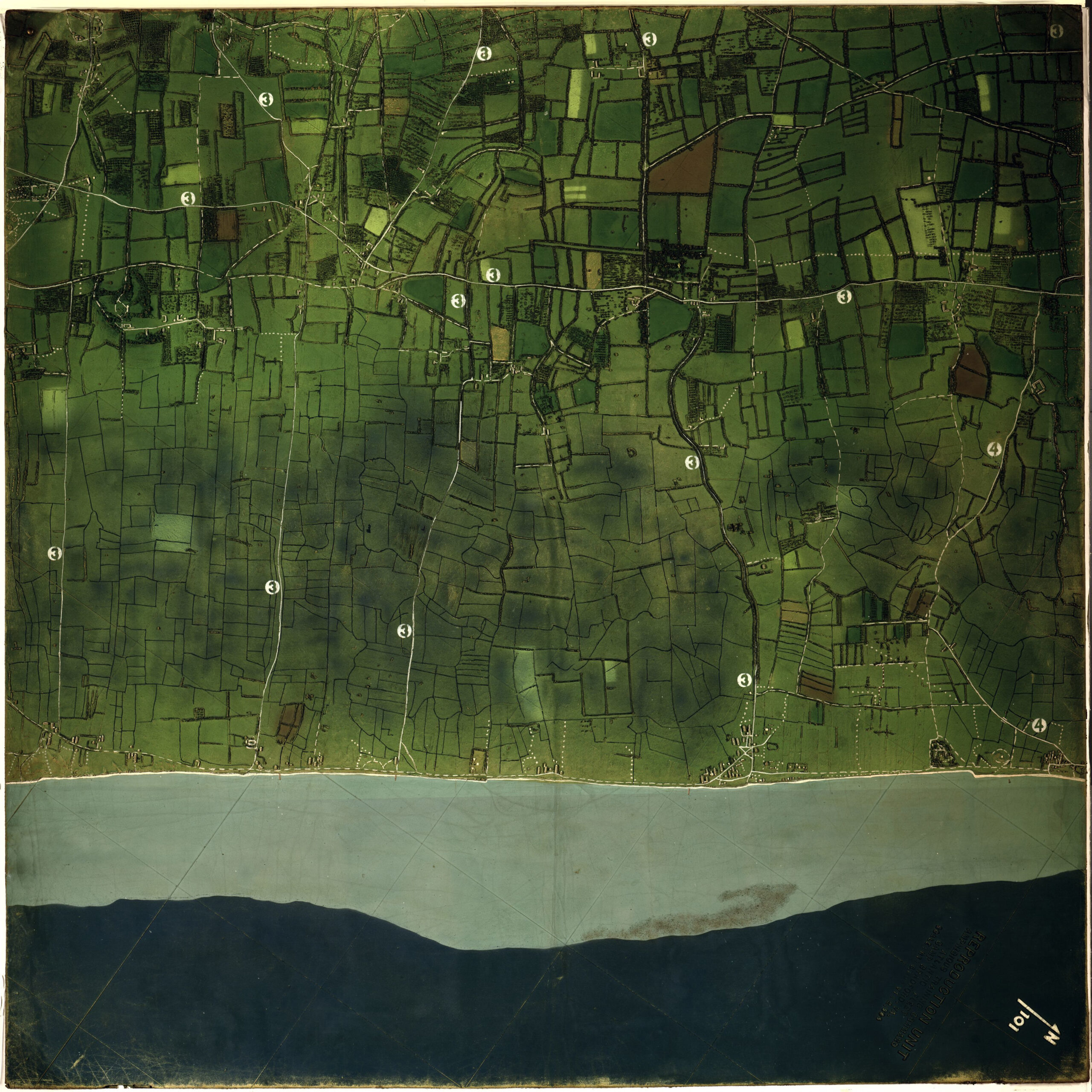
On June 4th, 1944, the day before the original date set for D-Day, a 27 year-old U.S. naval officer stood before this Top Secret three-dimensional relief map  and nervously briefed the top brass of the allied armies, on the upcoming seaboard assault at the Normandy coastal areas code named Utah. His audience included British Field Marshall Montgomery, commander of the entire sea and land assault (Operation Neptune), and American General General Eisenhower, Supreme Allied Commander for the European Theater of Operations.

At that the time it was a brand new technology, created in secrecy and kept that way until after the war had ended. Made at Camp Bradford, Virginia, and completed less than three days before it was flown to England, it was derived from stereo photos taken from reconnaissance planes. The map then went aboard ship after that first briefing, where it was used to instruct of the U.S. 4th Infantry Division that would be making the assault.

That officer was Charles Lee Burwell. He held onto the map and in later years donated it to the Library of Congress. He is quoted as saying he felt it was an important technology, because the 3D aspect of the map allowed soldiers to better know where they were going and what they should expect to see there, in terms of buildings, trees, and hedgerows. Utah Beach Detail 1944 2021 onemanz_com
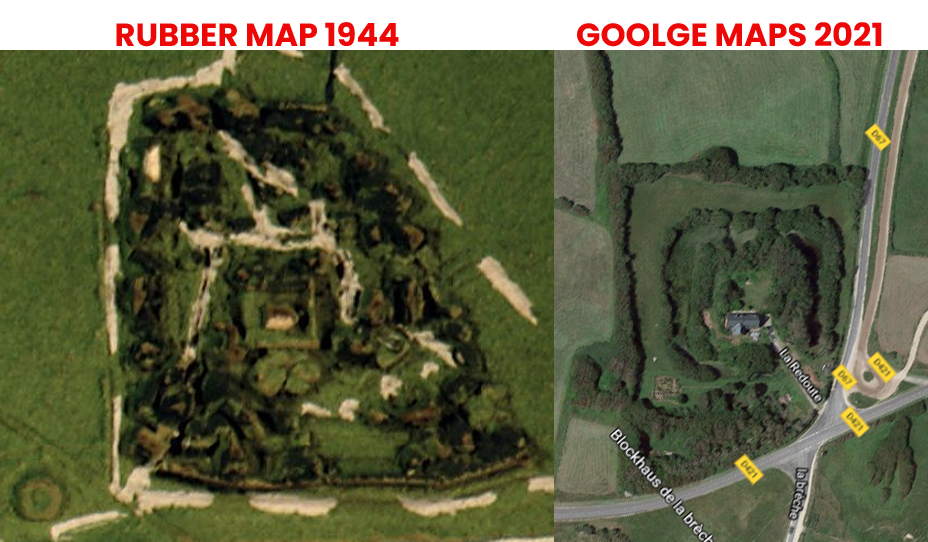
The map consists of two halves, each 4 feet square, made of rubber on top of foam. The numbers on the map correspond with other more traditional maps developed for the invasion. Up close, it reveals tide lines, slope of the beach, buildings beyond the beach, and the location of anti-landing craft hazards known as Czech hedgehogs. The depth of the water is represented by bathymetric tints and the color of the land was approximated from black white photos.

With Extreme Prejudice

This traditional map is code named Bigot, which was the highest level of secrecy possible. Many thousands of lives depended upon the success of the operation – millions in fact, if one considers those suffering and dying under Nazi occupation. Like the rubber map, this tactical map was created in two sections. This one shows the extreme left of the Utah Beach area, but it includes the actual invasion location.
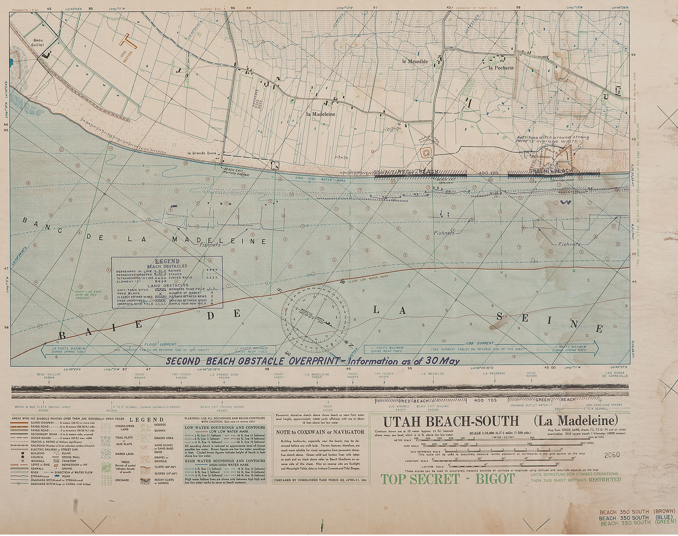
Utah Beach Bigot map ful size onemanz.com
click to enlarge

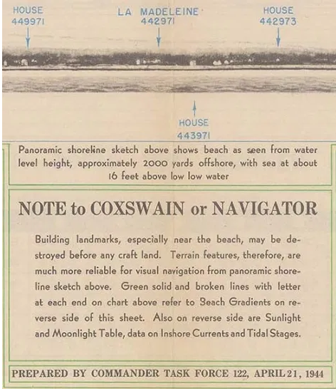
This detail below shows photographic representations of the waterline view of the coast represented on the map. These photos would have been taken from midget submarines with a crew of two, and sometimes four men, at great risk to their lives. These British sailors were among the relatively unknown heroes of D-day.

A Wrong Turn with Destiny

Utah Beach Bigot map Detail waterline onemanz_com

The small inland hamlet of La Madeleine is pictured to the left of the Utah landing areas, code named Uncle Red and Tare Green (designated as Red Beach and Green Beach in the map above.) But the strong tidal currents forced the landing craft more and more eastward, so they actually landed at le Grande Dune on that fateful morning.

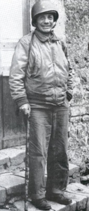
Although the First Wave arrived in the wrong place, their commanding officer, Deputy Division Commander, U.S. 4th Division, Brigadier General Theodore Roosevelt Jr., famously decided to start the war from there, and reinforcements were directed to land at his location. This inadvertently saved many lives, as first assault waves would have encountered greater and more deadly resistance had they landed where intended.

Not that they were not subjected to genuine peril. General Roosevelt was put in for the Distinguished Service Cross for his gallantry on D-Day. He lied about his poor health to insure he would be allowed to lead the First Wave, and then repeatedly led troop concentrations off the beach and toward their various objectives, while often under heavy fire from mortars and small arms. After he suffered a fatal heart attack in July, while still in the field, his decoration was upgraded, and he received the Congressional Medal of Honor, posthumously.

Here is an overlay I created, with a strategic map for the 8th Infantry Regiment, U.S. 4th Division, superimposed over the rubber map from 1944.
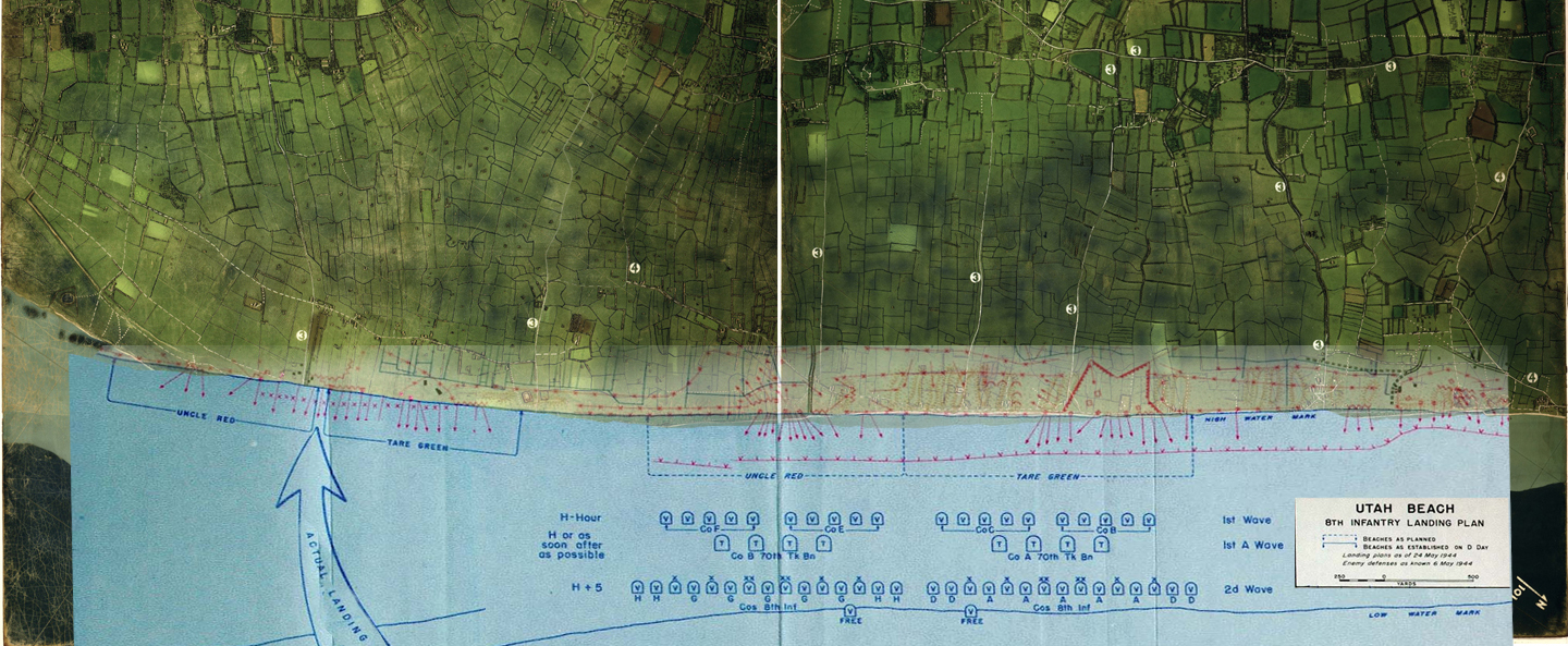
click to enlarge


Landing
wave
Time in BDST (British Double Summer Time) and relative to H-Hour Event
00:48 H – 05:42 Paratroopers of the 101st Airborne Division are dropped inland, around Sainte-Mère-Église. Drops continued 00:48 – 01:40.
01:51 H – 04:39 Paratroopers of the 82nd Airborne Division are dropped inland, around Sainte-Mère-Église. Drops continued 01:51 – 02:42. These airborne drops were followed by glider landings with support troops and anti-tank guns.
04:30 H – 02:00 A raiding party armed only with knives swims ashore at Îles Saint-Marcouf, 6.5 kilometers off the coast, to silence the anticipated German observation post before it can raise an alarm over the approaching invasion fleet. However, it turned out to be unoccupied.
1st 06:30 H 20 LCVPs, Higgins Boats or standard landing craft, each with a 30-man assault team from the 8th Infantry Regiment.
2nd 06:32 H + 00:02 32 LCVPs, each with a 30-man assault team. This included some combat engineers and eight naval demolition teams to clear away underwater obstacles.
3rd 06:15 H + 00:15 8 LCVPs, with tanks bearing bulldozer blades.
4th 06:17 H + 00:17 Mostly detachments of the 237th and 299th Engineer Combat Battalions, to clear the obstacles between the low-water and high-water lines.

By early afternoon, elements of the 4th Infantry Division had moved inland and linked up with elements of the 101st Airborne Division. By the end of D-Day, 23,250 troops and 1,700 vehicles had been safely landed on Utah Beach. Casualties were relatively light on Utah Beach. However, this was due in part to the inland actions of the 13,000 Airborne troops who suffered heavy losses. The 101st Airborne Division lost about 40% of its forces on D-Day.

The above table was found at someone’s personal travel website, https://cromwell-intl.com/travel/france/normandy/utah-beach.html

And here is a portion of the rubber map superimposed over a Google map of the same area. Note that just beyond the top of the rubber map is found the location of Brecourt Manner, where elements of the U.S. 101st Airborne destroyed a battery of four 105mm cannon that were firing on the troops at Utah Beach, as made famous in the 2001 HBO miniseries Band of Brothers. This shows just how accurate and detailed the rubber map is and how invaluable it must have been to the success of operations on and around Utah Beach on D-Day and afterwards.
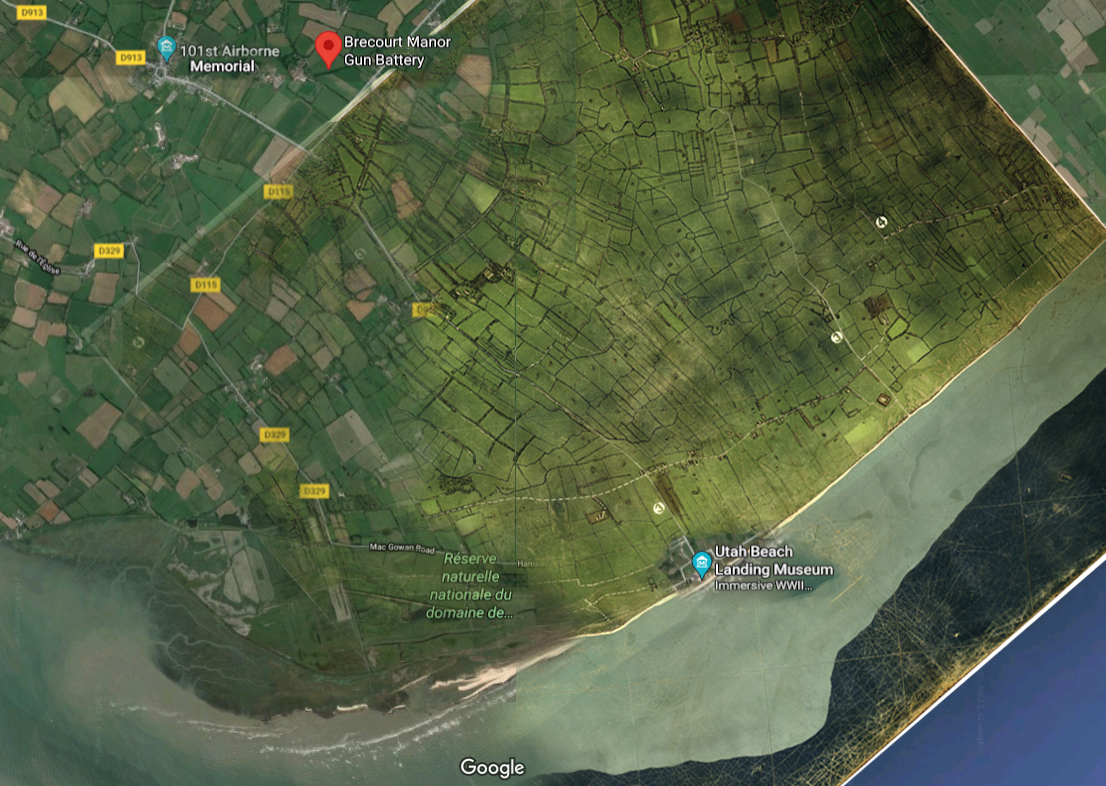
click to enlarge

And that is one man’s word on…

The Amazing Rubber Map of Utah Beach

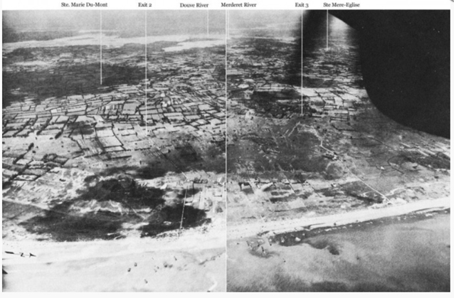
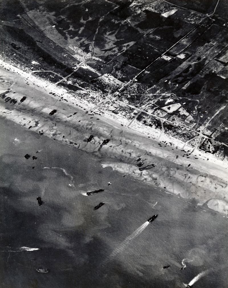
Aerial photos from that “day of days.”

Further Reading

Library of Congress conversation with Charles Lee Burwell

The American Memorial at Utah Beach
 

Arlington National Cemetery – Monday Map

Memorial Day 2021

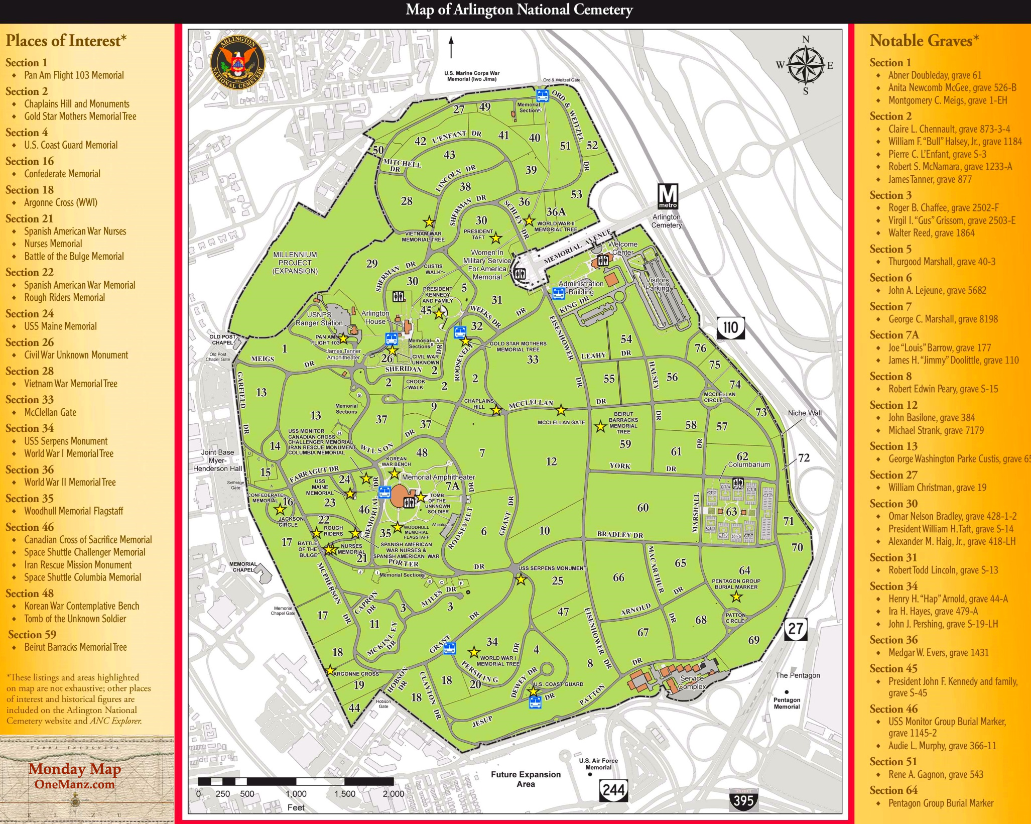
Arlington National Cemetery is reserved for members of the armed forces, their families, and other special dignitaries

Arlington_National_Cemetary_Map_Memorial_Day_onemanz.com

Lest We Forget

Memorial Day is set aside to commemorate all members of the armed forces who died in the service of their country. Many of those whose remains are interred at Arlington gave their lives in such a manner. Other war dead are buried in private cemeteries, and in military cemeteries around the globe, in the foreign lands and U.S. territories where they fell.

Others who lived beyond their time in the service may find a final resting place at Arlington as well. But the space is limited, so such an honor has required a particular application process since the 1990s.

In the darkest days of the American Civil War, the military cemetery near the nation’s capital was nearly full. The former estate of Robert E. Lee and the ancestral home of his wife Mary Custis  was chosen as the first burial ground exclusively used for federal soldiers killed in battle during recent fighting.

This was done partly because the location on a hilltop in Virginia was visible from the Mall in Washington D.C. and partly to insure that the leader of the most high-profile army fighting in rebellion against the U.S.A. could never again live there. The officer in charge made sure to put burials as close to the Custis mansion as possible, including the grave of his own son.

Some twenty years after the war, the cemetery started to gain a special aura as a national shrine, as revered generals and other famous heroes of the conflict began to pass away. The Tomb of the Unknown Soldier was installed in 1921, and eventually remains from service personnel who perished in every major conflict going back to the American Revolution have been interred in grounds of the cemetery.

Among the few buried there who did not serve in the Armed Forces or were not one of their dependents is William Howard Taft, the 27th president of the United States and the 10th Chief Justice of the United States Supreme Court, the only person to have held both offices.

A Day to Remember

Memorial Day has its roots in local commemorations for Civil War dead, often referred to as Decoration Day, when citizens would decorate local graves with spring flowers. After the First World War the idea was expanded to include graves from any conflict and ultimately included those who died while on duty, whether that was related to warfare or not. It was observed on a national level on May 30, beginning in 1868. It became a federal holiday in 1971, officially taking place on the last Monday in May.

Schoolchildren and other less-informed people often confuse Memorial Day with Veterans Day. The latter was once called Armistice Day, and still is in other nations, as it was originally its own Memorial Day, honoring those who lost their lives in the First World War. In America, that practice was transferred to Memorial Day, and Veterans Day became a time to salute and pay homage to all who have put on the uniforms of the Armed Forces defending the United States from foreign foes.

Now that so many veterans of World War Two, Korea, and Viet Nam are passing away years after they left the service, the lines between the two days are beginning to blur. But officially, Memorial Day is for those who died while in the service of their country. Veterans Day is for those living or dead who did not give their lives for their country but still served their country with honor.

Here is a link to a PDF to the Arlington National Cemetery Burial Eligibility Act of 1998 that states the specifics of who is allowed to be considered for internment, as well as some historical perspective.

May 10, 1871 – Transcontinental Railroad – Monday Map

Transcontinental Railway Map 1871 onemanz
Circa 1871 (Click to Enlarge)

The Railroad that Helped make the USA One Place

One-hundred and fifty-two years ago today

The “Last Spike” connecting the Union Pacific and Central Pacific Railroads took place on May 10, 1869. It took seven years from the time Congress approved the creation of a Transcontinental Railway in 1862. But it was being planned and discussed for decades beforehand.

Construction began in 1863, as the horrendous Civil War tearing the nation apart. But just as the war changed the USA from being a bunch of separate states into nation indivisible, the transcontinental railway unified the nation geographically. According to one university history site, before the railroad’s completion, it cost approximately $20,000 in 2021 money to travel from St. Louis to San Francisco by stagecoach. Afterwards the price was a fraction of that cost, and continued to drop as more rail lines were completed off of the original route.

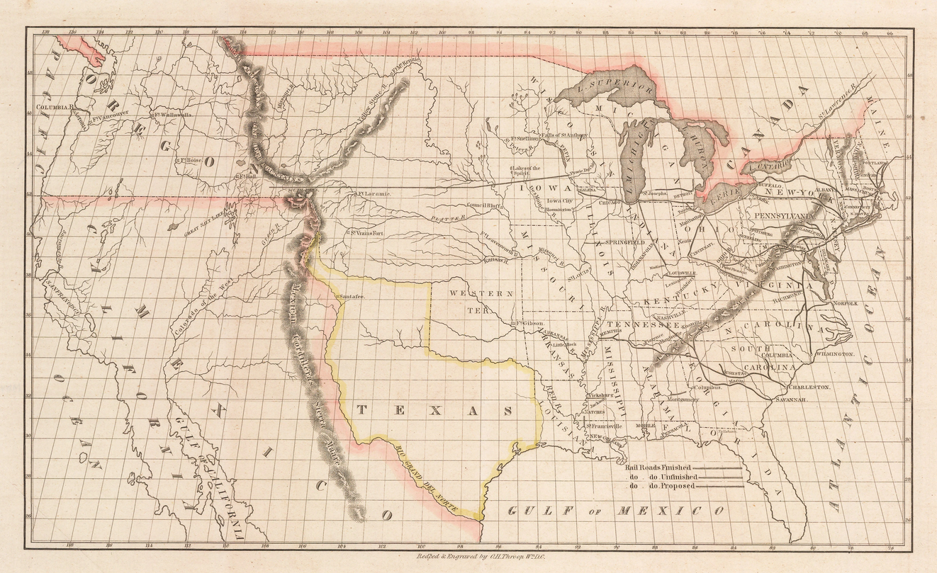
Talk of such a project goes back at least to 1830, when the first steam engine locomotive arrived on this side of the Atlantic. In 1845, the adventurer and businessman Asa Whitney petitionedCongress to provide land grants necessary to create a railway across the northern swath of America, to Oregon Territory, where he had already made a fortune trading with the Far East. Evoking the spirit Lewis and Clark, Whitney commissioned this map to entice investment in his grand scheme.

1845 transcontinental railroad northen route map
(Click to Enlarge)


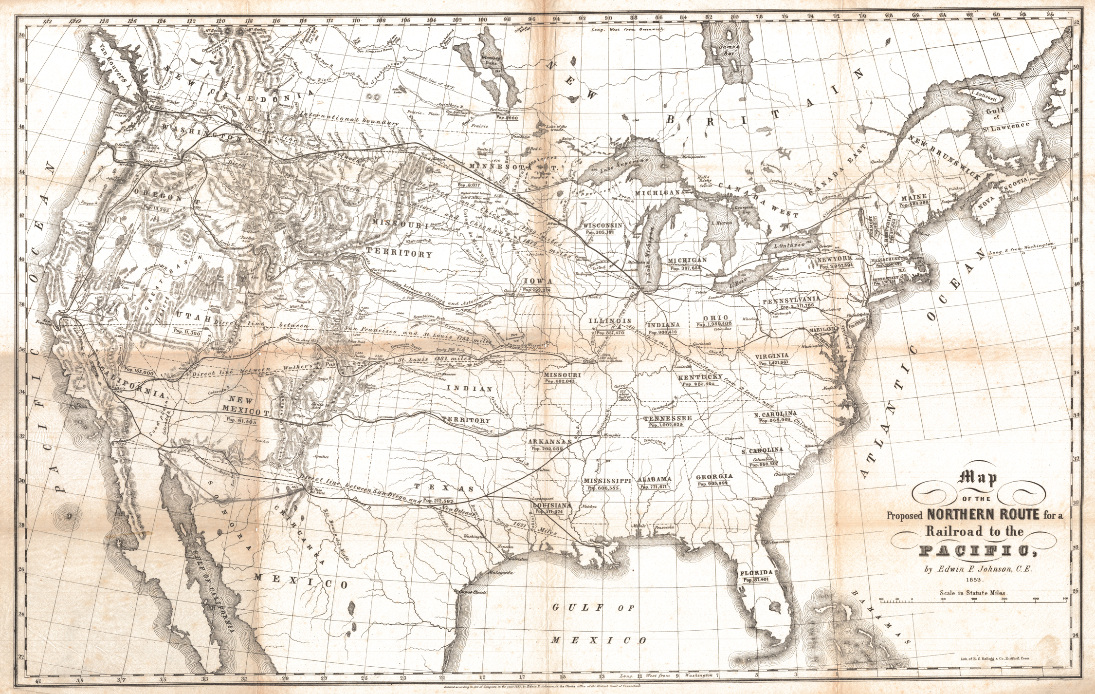
Thirty years later, it was other entrepreneurs who realized this long outstanding dream. But there were many competing propositions as to where exactly the route should end up, as seen in this map from the early 1850s.

Transc railroad proposed routes 1853
(Click to Enlarge)

Underway at Last

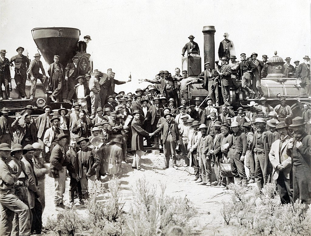
Even after the two companies received the go-ahead, work was nearly completed and the eastern Union Pacific Railroad Company and the western Central Pacific Railroad Company still could not agree on where the their routes should meet. Maps from the time show all proposed routes running south of Utah’s Great Salt Lake. Eventually the government under President Grant threatened to withhold further funding until the two companies came to terms as to exactly where they would join together to create the single route from east coast to west. And it ended up being Promontory Summit, Utah, north of the lake.

Promontory Summit photo transcontinental railroad completion onemanz
(Click to Enlarge)

Despite the Central Pacific having to cut their way through the mountains, and the harsh working conditions of their laborers, including many Chinese immigrants, it was the Union Pacific that suffered the greatest loss of life. Many hundreds died on both sides, from accidents, exposure, disease, and attacks from Native American tribes, who couldn’t quell the tied of westward expansion that ultimately led to formation of the lower 48 states as we know them today.

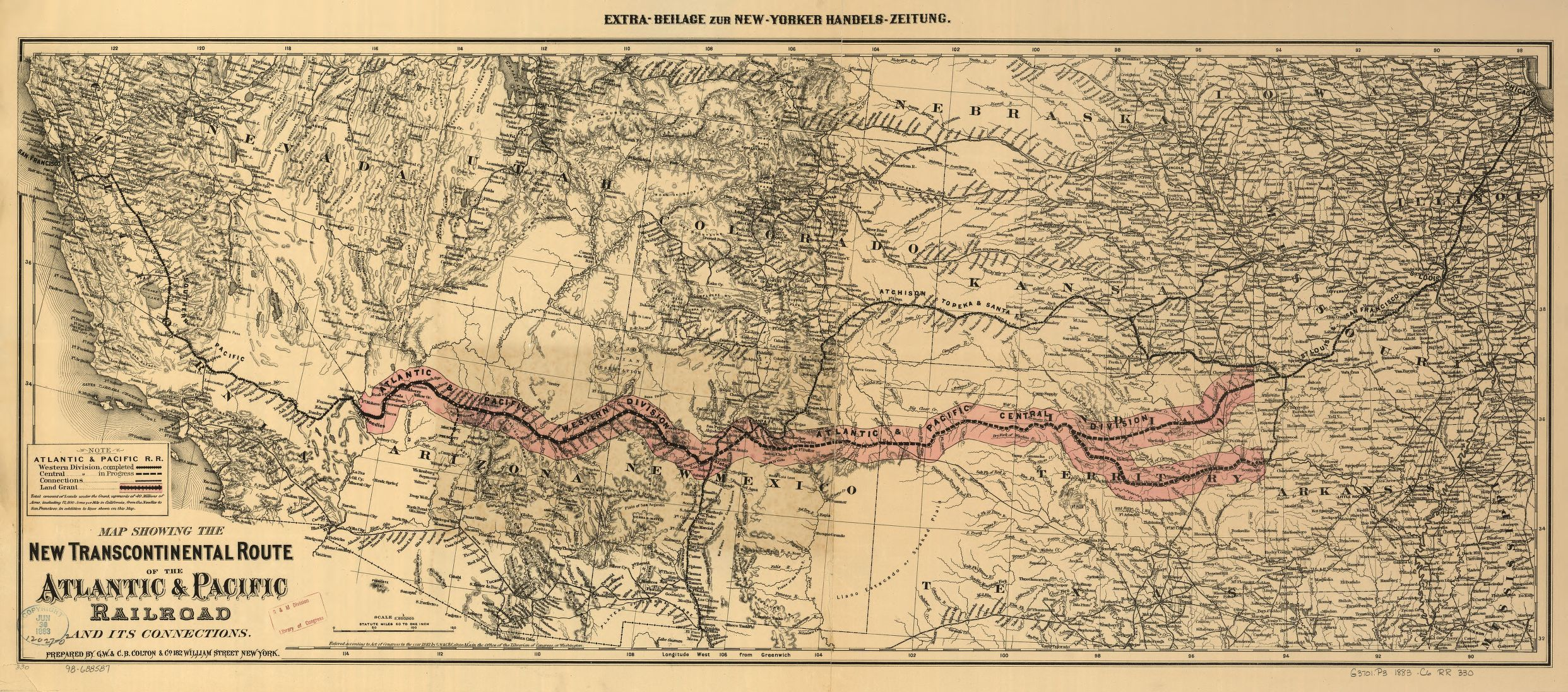
Here is another map, from 1882, of a proposed southern route that didn’t end up being created as envisioned.

Transcontinental railroad actual route 1883 onemanz
(Click to Enlarge)

And that is one man’s word on…

The Transcontinental Railroad

Monday Map – New York 1776

George Washington and New York City are Forever Linked

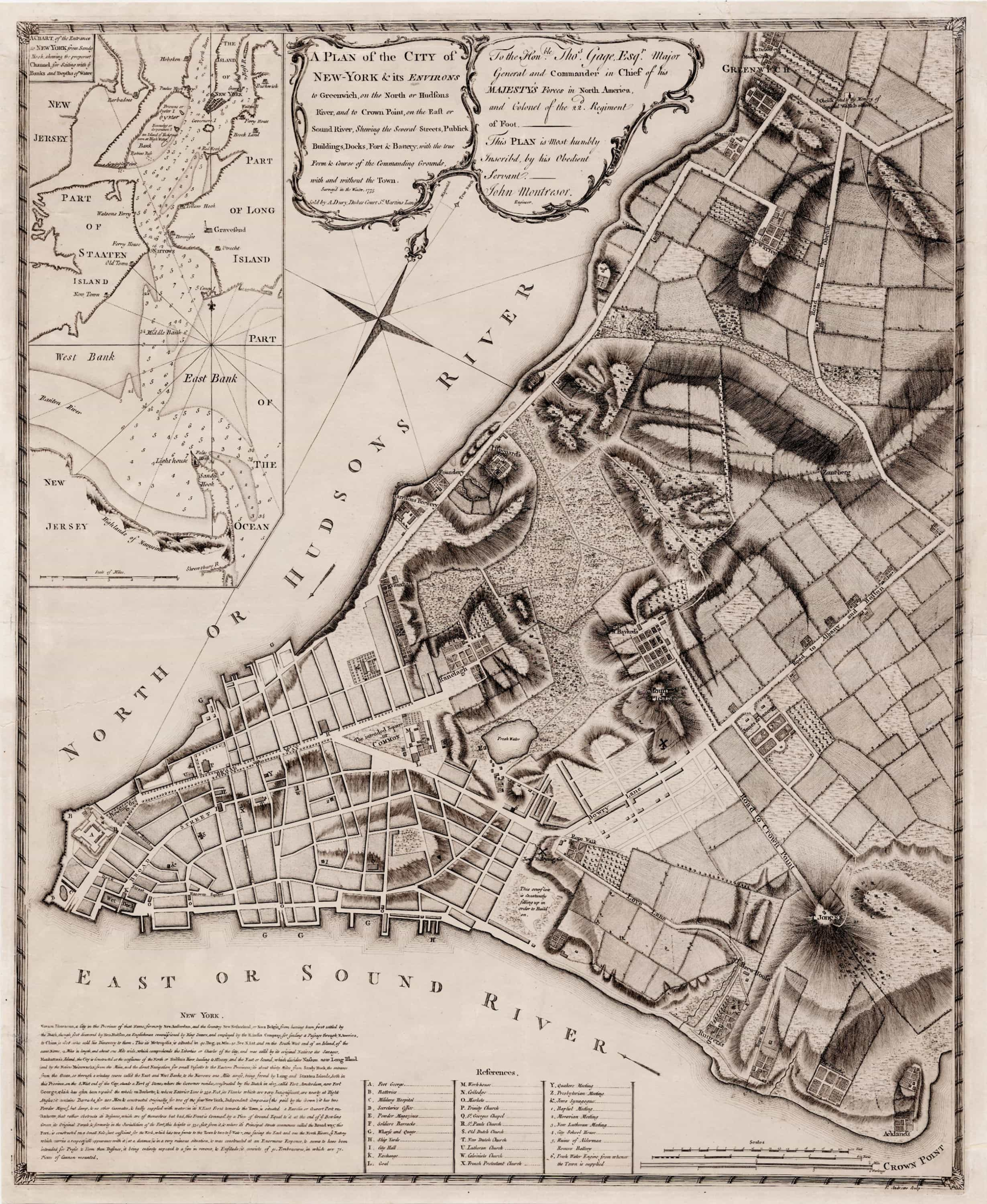
This map was used by Washington to plan the defense of New York City against British invasion

Click to Enlarge and Zoom In

New York Map1776 George Washington onemanz s

Today is George Washington’s 289th birthday

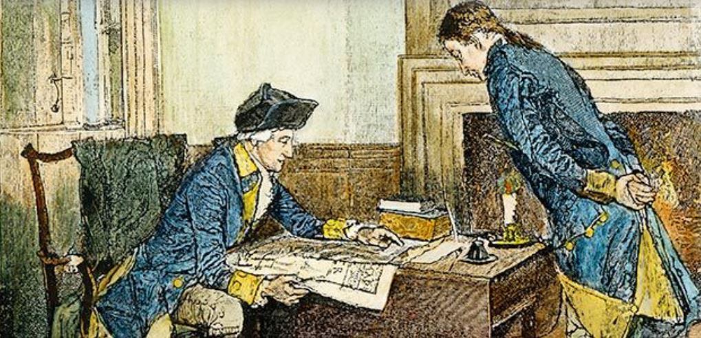
First in war, first in peace, and first to have a birthday sale named after him, Washington expected the Battle of New York to be his first test as the new commander of the Continental Army during the American Revolution. His opponent, the Viscount Willam Howe, had other ideas.

Both commanders knew the city would have been destroyed had it been directly involved. But Washington used this map with the express purpose of fighting house to house in hopes of inflicting extensive casualties upon the much larger forces of the Crown.

Instead of a direct assault, Lord Howe landed his army outside of New York Harbor, on what is now Brooklyn, where the Battle of Long Island took place on August 27, 1776. Outnumbered and outflanked, it turned into a major defeat for Washington. But as historian David McCullough makes clear in his excellent book, 1776, it was Washington’s masterful series of strategic withdrawals that saved most of his army, and the future of the USA along with it.

The British commander repeatedly out-maneuvered the Americans before, during, and after the battle, so they were forced to withdraw further up Manhattan Island to the heights later named for General Washington. And then they skedaddled all the way across New Jersey to Pennsylvania. The city had been spared, only to have much of it burned to the ground in the Great Fire less than a month later, on the night of September 20.

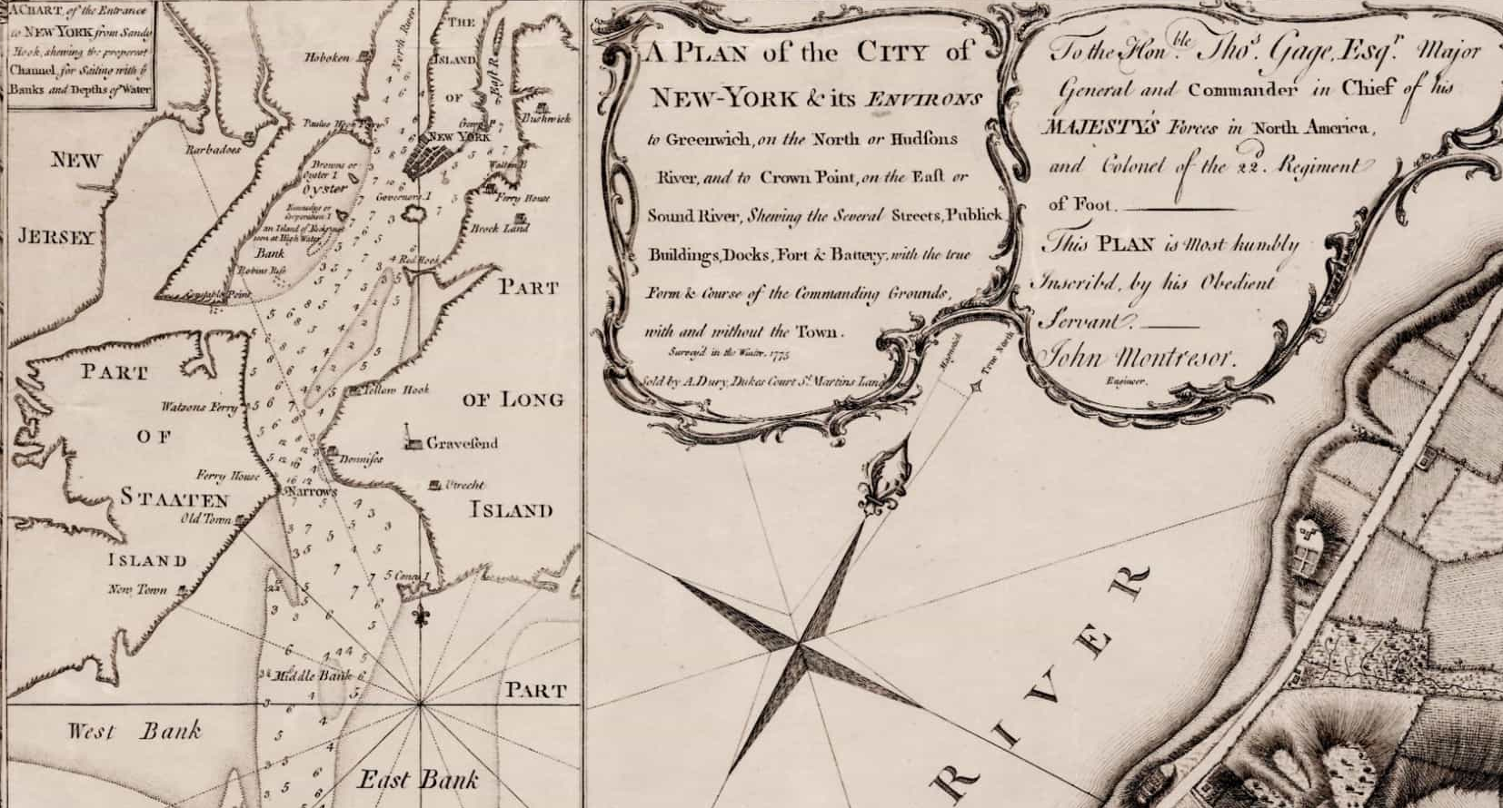
Originally drawn by British Army engineer John Montresor, the specific map Washington used is housed in the collection at Yale University Library.

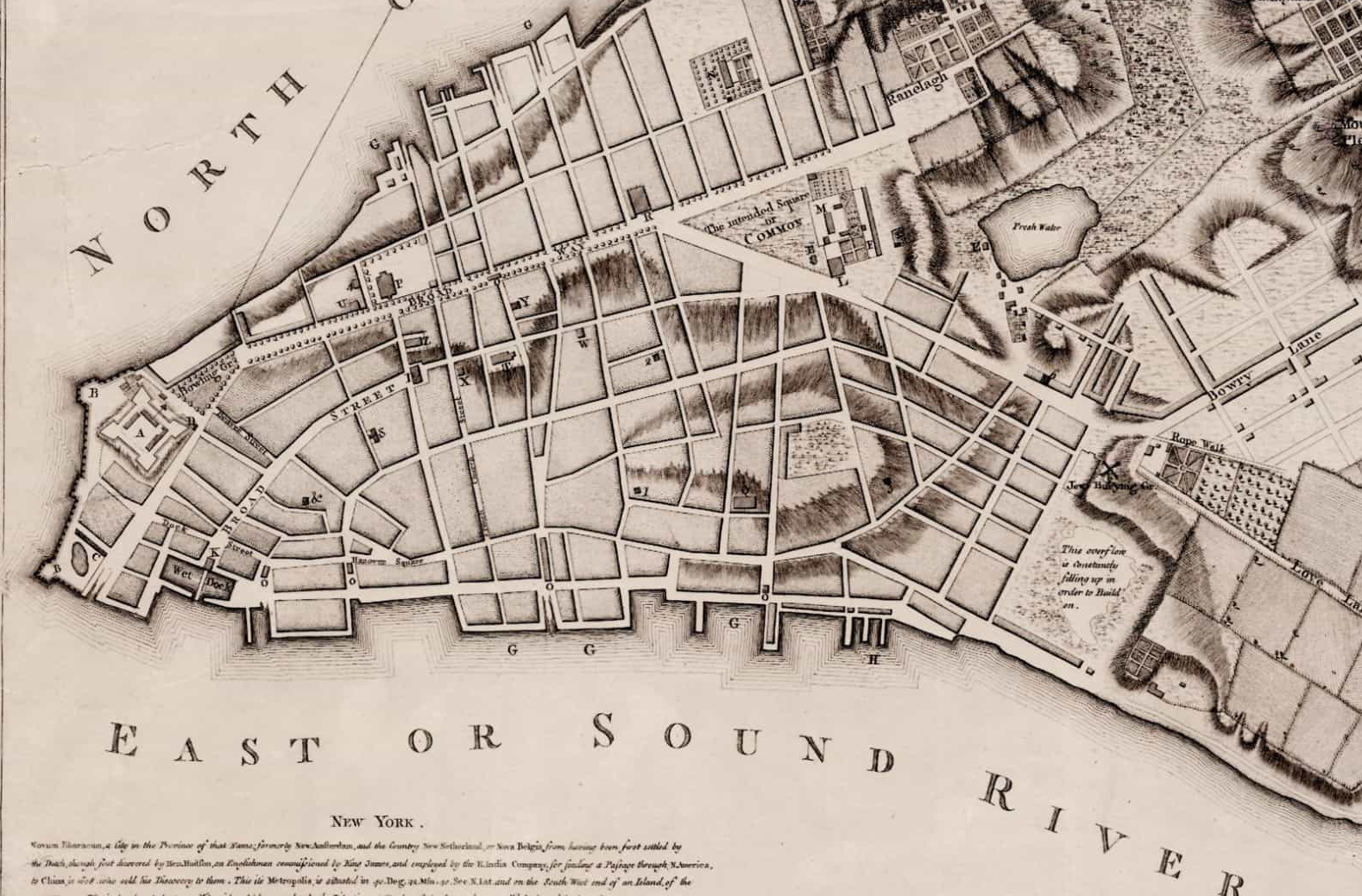
New York Map1776 George Washington onemanz detail 1

The City of New York in 1776. Broadway has 13 blocks (it is now 13 miles long.) What is City Hall today and its park were still an “intended square or COMMON.”

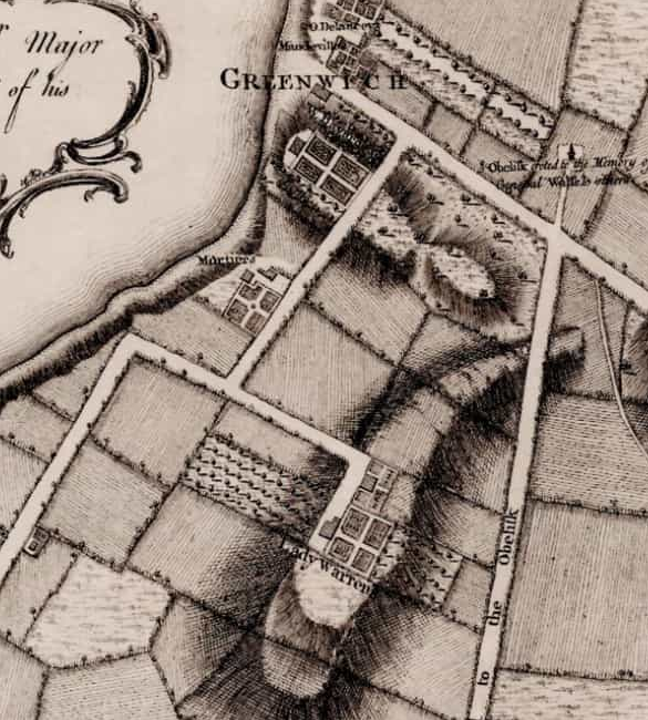
New York Map1776 George Washington onemanz detail 2

Part of Greenwhich Village and the estate of one Lady Warren (née DeLancey,) the recently deceased widow of the intrepid Admiral Sir Peter Warren of the Seven Years War with France, whose remains were interred in Westminster Abbey after an illustrious career in Parliament.

New York Map1776 George Washington onemanz Greenwhich

Never losing his nerve, George Washington survived to fight another day, and many other days yet to come, beginning with the surprise attack victory at Trenton, New Jersey, on Christmas Day, 1776.

Six years of savage fighting later, George Washington returned to New York to say bid farewell to his officers at Fraunces Tavern, which still stands at 57 Pearl Street. General Washington did not know he would soon return to the City of New York, the first national capitol of the United States America, were he served as its first President.

I first learned of this NYC map thanks to the very cool article in Smithsonian Magazine on Washington’s personal map collection, in November of 2010, currently available on line at the link below.

Washington's maps Smithsonian onemanz.com

https://www.smithsonianmag.com/history/george-washington-and-his-maps-72194830/

COVID-19 Verified Infections – Monday Map

Confirmed COVID-19 Cases

A tip of a deadly iceberg, as confirmed cases are certainly but a small fraction of actual infections

COVID-19 map May 8 onemanz.com

Amidst the bizarre and frightening collective denial of millions of Americans, misled by their President, and bamboozled by their own ignorant hubris – and their almost unbelievable selfishness – the United States is poised for a disaster unprecedented in American history.

The rest of the world looks on in horror as what was once the leading nation of the world willfully exposes countless citizens to unspeakable suffering and death in the name of greed and stupidity. And in doing so, the USA is becoming the greatest threat to the people of all other nations in the world today.

Far more tragic than the ravaging pandemic is what it has revealed about the American people. Not all to be sure, but far too many for Americans to ever again claim that theirs is the greatest nation in the world, or even the best country, or even the right to claim we as a people possess the least common decency and good will called for by any of the major religions in the world today.

The Pacific – Monday Map

This map helped win the War in the Pacific, 77 years ago today

(click to enlarge)

The Pacific 1942 National Geographic Map

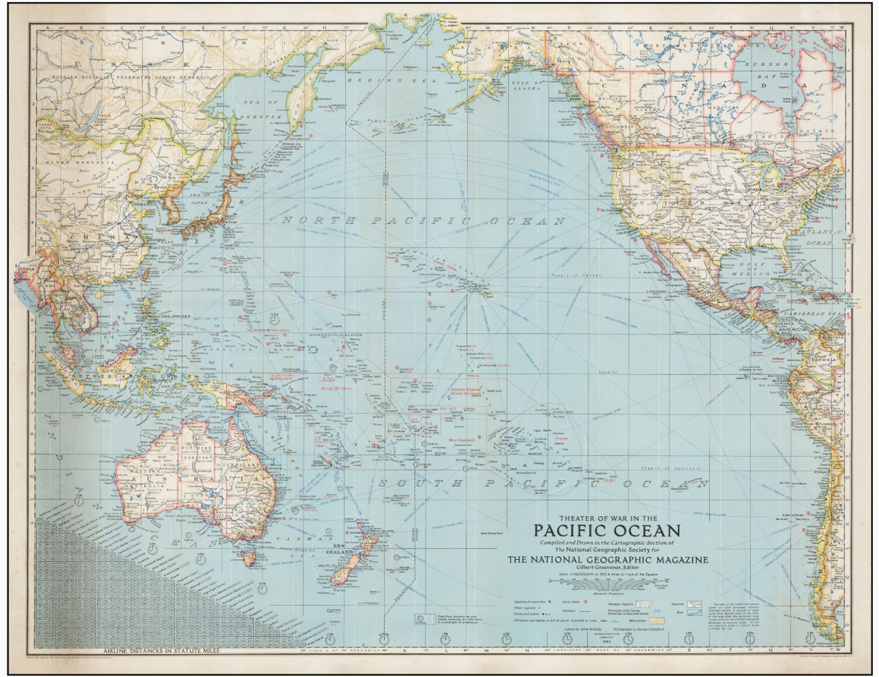
The February 1942 issue of National Geographic contained this map entitled the Pacific Theater of War.

It was published less than two months after the coordinated attacks launched by Japan across the Pacific and Western Asia on December 7 – 8, 1941, including the aerial bombardment of Pearl Harbor in the Hawaiian Islands.

It is not an exaggeration to say this map actually helped win the Second World War

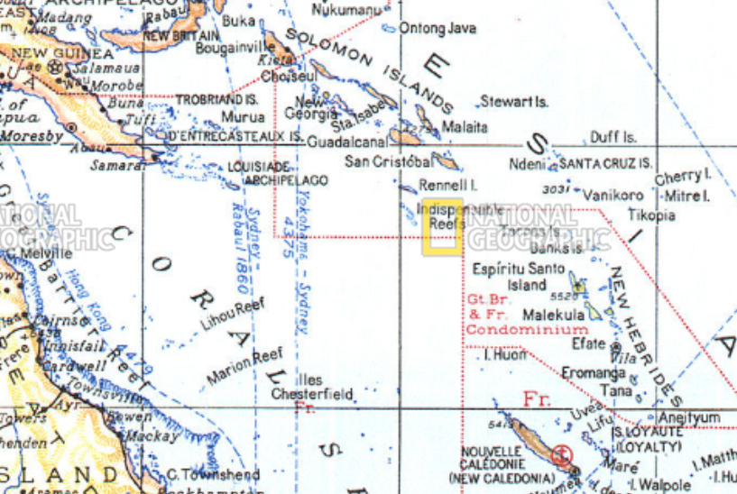
On the 30th of September, 1942, a B-17 bomber of the United States Air Force left the island of New Caledonia, 912 miles east of Australia. It was heading to Guadalcanal, in the Solomon Islands, some 830 miles over open seas. On board was Admiral Chester Nimitz, the overall commander of the American force that had been engaged in a ferocious battle on Guadalcanal for nearly two months against the Empire of Japan, which would continue until February of the following year.

Due to poor weather and insufficient navigational charts, the plane was in danger of running out of fuel before it found the way to its destination. But the Admiral’s aide, Commander Hal Lamar, happened to have the February issue of National Geographic in his gear. It contained the map displayed above, which the pilot was able to use to navigate successfully, arriving with a scant few gallons of fuel remaining.

The Pacific 1942 National Geographic zoom

source: natgeo maps

The Admiral and his staff touched down in a driving rainstorm on Henderson Field, where he immediately performed an inspection of the front lines, at a time when it was seriously in doubt that the Americans could hold out against a foe that was determined to win at all costs.

Based on his firsthand assessment, Nimitz’ actions over the coming month included replacing high ranking officers involved in the battle, and proved decisive in the Allies’ first significant victory of their “island hopping” strategy in the Pacific Theater.

Without this map, Admiral Chester Nimitz and his staff could very well have ended up among the 78,700+ American service men and women listed as Missing in Action by the war’s end. And the Battle of Guadalcanal and the ensuing War in the Pacific might have gone very differently.

A wonderfully zoomable map made from the original 1942 map can be seen HERE.


Rome From Start to Finish – Monday Map

Rome Wasn’t Built in a Day

I’ll Say!

Monday Map – The History of Rome

A special birthday edition features an animated map that explores the entire history of Rome, from its earliest days as a kingdom, through the massive expansion during the Roman Republic, and on through Roman Empire, which split in two for its final tumultuous years.

Please expect to want to hit Pause and stop to look at certain moments of the timeline in detail!

I never grow tired of history or maps, and love it when they come together so very well.