The band that invented Americana music, 50 years ago this week.

July 1, 1968 the band called the Band released Music from Big Pink

They changed American music forever

But not just American music was widely influenced by this scraggly group of Americans and Canadians. Eric Clapton heard the record and decided to quite what he was doing and go do something else. He even considered moving to Woodstock, NY to meet these guys and talk them into letting him join the Band.

Here’s the Band 30 years later, joined by the Staple Singers, performing the most iconic song from that first record.

50 Years Ago – CSN

Three unique voices joined as one for the first time, fifty years ago today… and became CSN

As the story goes, David Crosby listened to Stephen Stills and Graham Nash singing a song at a small dinner party, and asked them to sing it one more time…

As can often happen one half century later, Stills and Crosby differ on the exact where and when it happened. The important thing is, it happened.

Happy Birthday, Mr. Lincoln

This photo of Monuments by Moonlight Night Tour is courtesy of TripAdvisor

It’s been a long time since we had a Republican President who actually meant what he said and who gave a tinker’s cuss for non-wealthy Americans, minorities, and justice for all.

“With malice toward none, with charity for all, with firmness in the right as God gives us to see the right, let us strive on to finish the work we are in, to bind up the nation’s wounds, to care for him who shall have borne the battle and for his widow and his orphan, to do all which may achieve and cherish a just and lasting peace among ourselves and with all nations.”

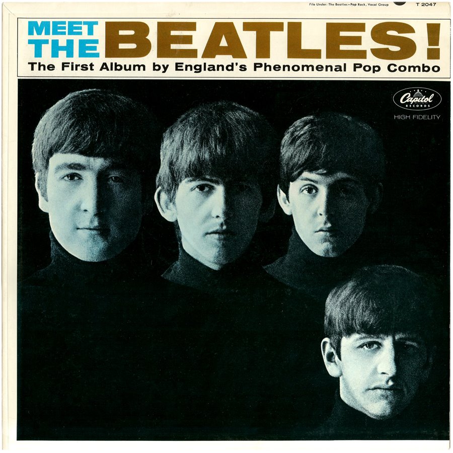
Meet the Beatles

Released 54 years ago today, Meet the Beatles was the first Beatles album released in America

Meet The Beatles onemanz.com

My baby book said that my first favorite song was “I Wanna Hold Your Hand. “

Actually, it was “Saw Her Standing There,” but I think my mother felt that was a bit too risque, since the first line is, “She was just seventeen, if you know what I mean…”

It turns out Paul wrote the first half of the line, and John wrote the second. The rest is history

Positively 4th Street Revisited by Dylan

Bob Dylan Told Us What We Needed To Hear

Acrid truths that cut through the bubble gum and rose colored glasses

In September of 1965 the top charts of hit singles were full of young persons’ love songs, like Yesterday, I Got You Babe, Track of My Tears, California Girls, when Bob Dylan released Positively 4th Street…

“You got a lot of nerve to say you are my friend, when I was down you just stood there grinning…”

50 years later it is still an incredibly powerful song.

You got a lotta nerve
To say you are my friend
When I was down
You just stood there grinning

You got a lotta nerve
To say you got a helping hand to lend
You just want to be on
The side that’s winning

You say I let you down
You know it’s not like that
If you’re so hurt
Why then don’t you show it

You say you lost your faith
But that’s not where it’s at
You had no faith to lose
And you know it

I know the reason
That you talk behind my back
I used to be among the crowd
You’re in with

Do you take me for such a fool
To think I’d make contact
With the one who tries to hide
What he don’t know to begin with

You see me on the street
You always act surprised
You say, “How are you?” “Good luck”
But you don’t mean it

When you know as well as me
You’d rather see me paralyzed
Why don’t you just come out once
And scream it

No, I do not feel that good
When I see the heartbreaks you embrace
If I was a master thief
Perhaps I’d rob them

And now I know you’re dissatisfied
With your position and your place
Don’t you understand
It’s not my problem

I wish that for just one time
You could stand inside my shoes
And just for that one moment
I could be you

Yes, I wish that for just one time
You could stand inside my shoes
You’d know what a drag it is
To see you

Copyright © 1965 by Warner Bros. Inc.; renewed 1993 by Special Rider Music

The Moon Walk 50 Years On

As only the Onion would have covered the Moon Landing

Onion Moon Landing

To the moon with you!

Some 20 years ago, I was in a rehearsal hall in midtown Manhattan, surrounded by some 8 cast members and the stage manager of the play I was directing, as we discussed age differences in relationships.

I had mentioned there was a time when I told myself I would not date anyone who was born before the Moon Walk – a stipulation that was abandoned in later years.

On actress perked up to say, “I remember that! My mother got me out of bed to watch it on TV.”

She was referring to Michael Jackson’s performing his backwards shuffle on the MTV Awards.

EVERY person in the room assumed I was referring to the same incident.

The one that stands, oh, alongside the invention of the wheel and writing, as one of the greatest achievements in the history of human civilization seems to have been overlooked. And it continues to be taken for granted every since.

It seems the wrong Moon Walk has taken over the consciousness of Americans, if you can call it consciousness.

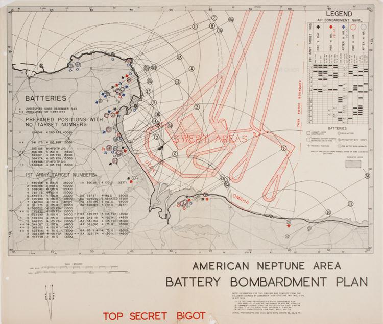
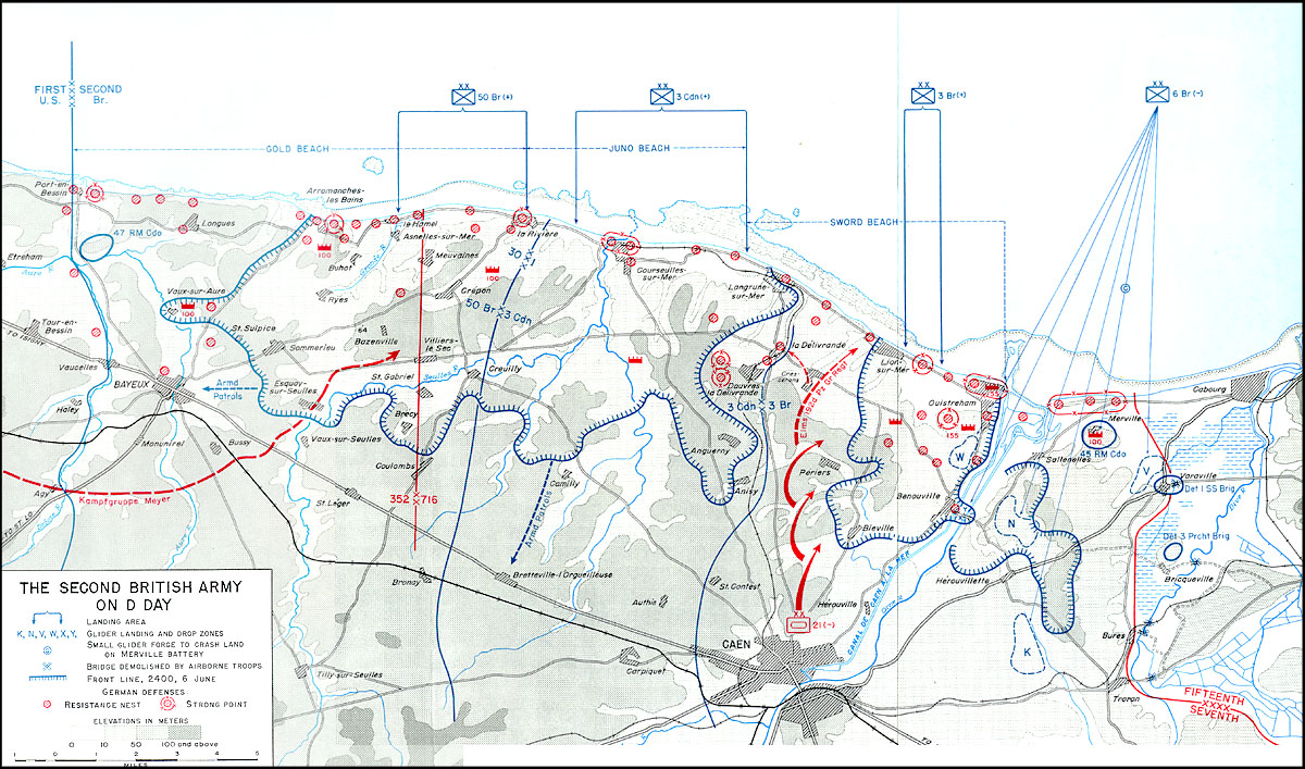
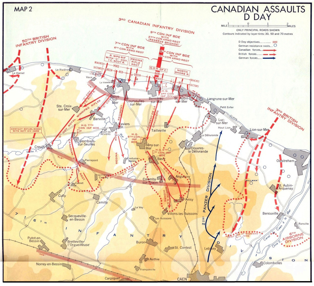
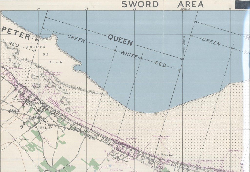
Normandy, June 1944 – Monday Map

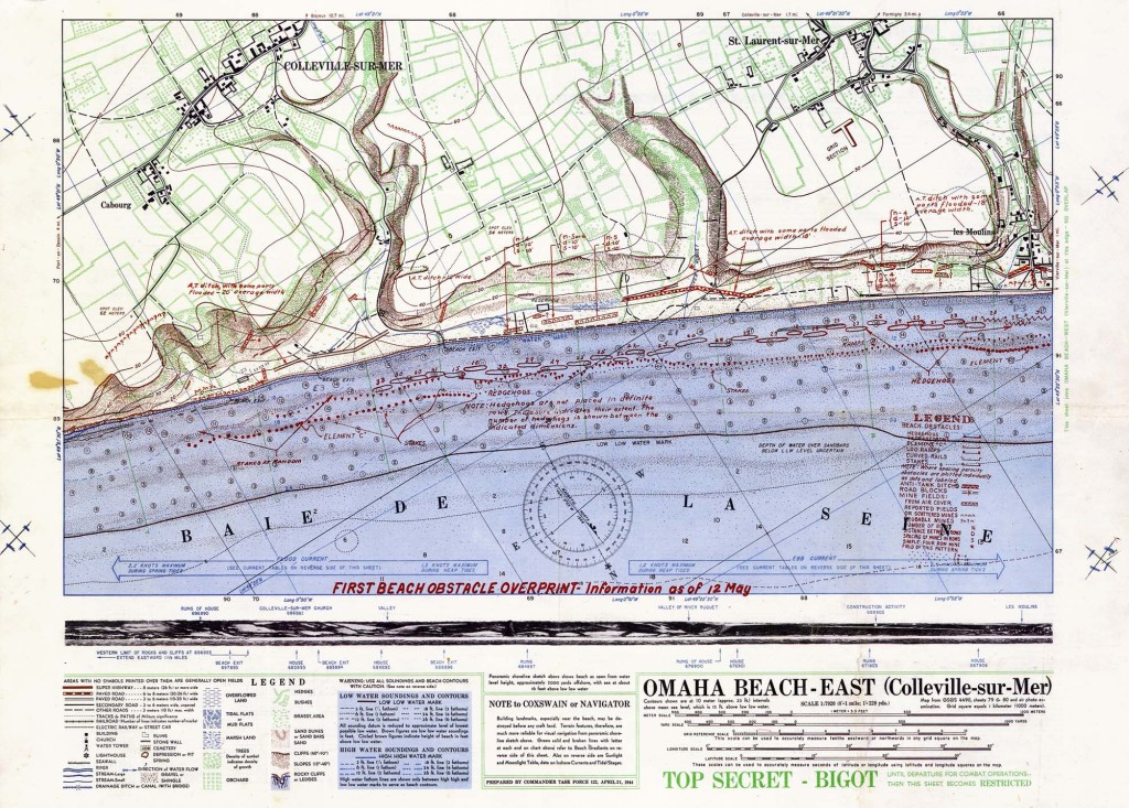
Complete with relief photos and elevation tables, the actual maps from the Normandy Invasion still inspire awe.

Classified as “Bigot,” the highest top secret security level possible, a very few persons even knew of the existence of this and other maps prepared for the assault on Hitler’s Fortress Europe.

Half of Omaha Beach

omaha_beach_east_f_1944_ Normandy2

omaha_beach_east_b_1944 Normandy

Source: Wikipedia

June Gloom and a Full Moon

June has come with gloom under low, unseasonably cool skies over New York City, mirroring the climate in Northwest Europe at the opening of the most monumental June in human history. [Now June 6, 2017, and it is 56 degrees and with a intermittent sea mist rain that makes this 73rd anniversary’s weather all the more like the 6th of June in Normandy in 1944, than when this was originally posted in 2015.]

The weather was so bad in the spring of 1944 that D-Day was postponed at the last minute, for 24 hours. So the first courageous airborne troops dropped from the sky a few minutes after midnight on June 6, to begin operations prior to the full scale assault that slammed into five beaches, as dawn lit the Normandy coastline west of Caen.

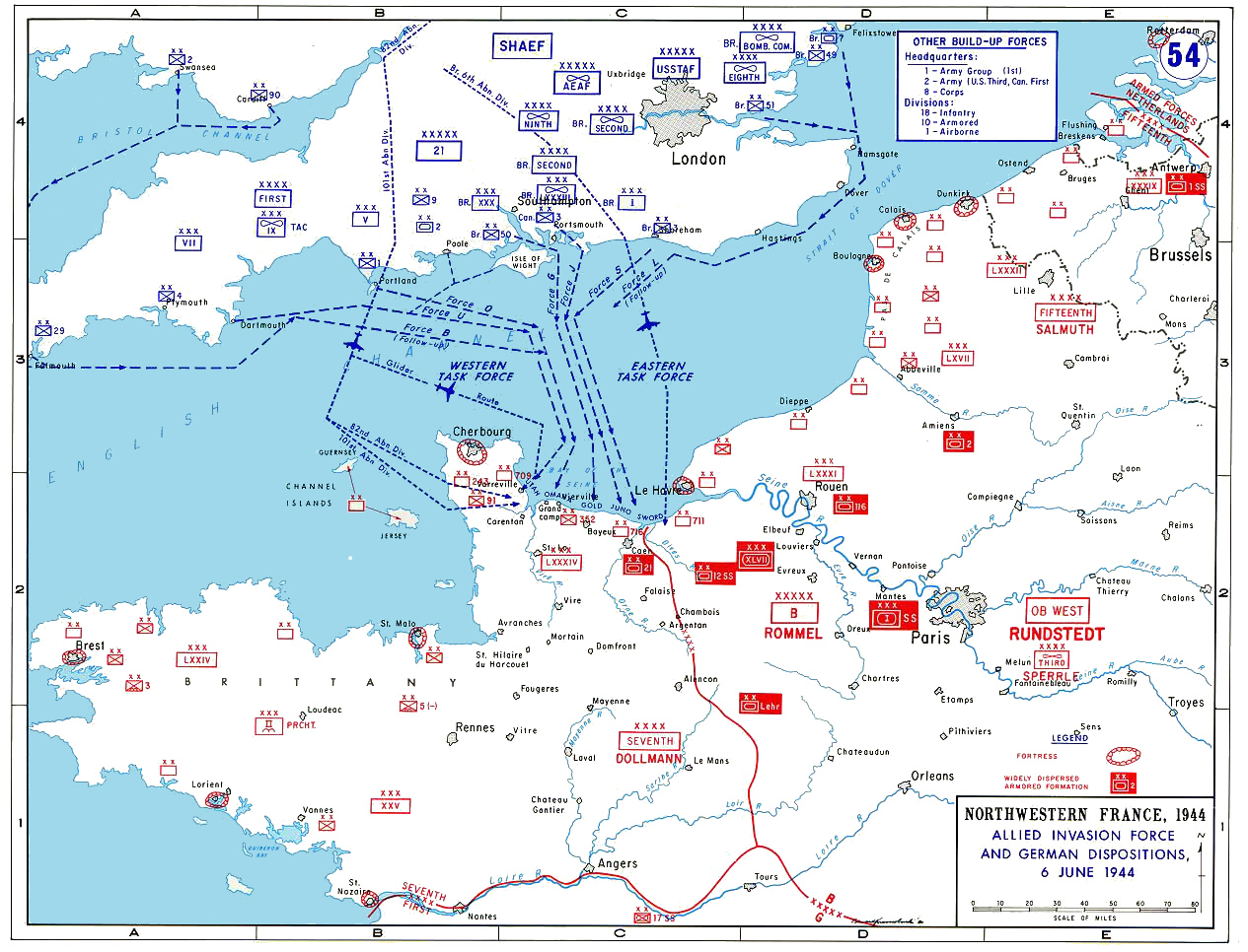
These maps give some indication of the enormity of the invasion, and the amount of detailed planning that went into it.

Some are taken from painstaking copies of original Bigot maps created for the D-Day landings, and available for sale at Alan Godfrey Reproductions.

 The Full Invasion Area

Allied_Invasion_Force_Normandy

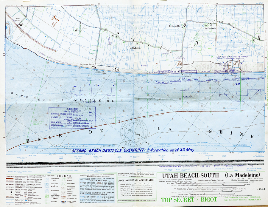
Half of Utah Beach

Utah_Beach_Map_Front_A Normandy

American Naval Operations (Operation Neptune)

D-Day navy map Normandy

British Empire Operations

Normandy Invasion Map

Canadian Assault on Juno Beach

Canadian D Day Landings Normandy

British Main Assault at Sword Beach

Sword Beach Normandy

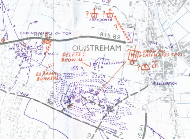
Detail from Bigot map of Sword Operations (English and Free French Commandos)

ouistreham Normandy map

Detail of British Bigot Map Legends

Map Legend Normandy

Other Reading:

Britannica’s D-Day site was created years ago, so it has some bad links, but it is full of interesting oral histories by veterans, as well as detailed charts and maps, and other information of interest.

http://kids.britannica.com/dday/browse?browseId=237176

U.S. Army official report on the action at and around Omaha Beach, 6 June 1944. This was prepared and provided to veterans at the 50th Anniversary commemoration in 1994, and based closely on the official report by the War Department, 20 September 1945

http://www.history.army.mil/books/wwii/100-11/100-11.HTM

Adygea Republic- Monday Map

The Republic of Adygea is virtually unknown in the West

Located within Krasnodar Krai, at the extreme southwest tip of the Russian Federation, near the Black Sea
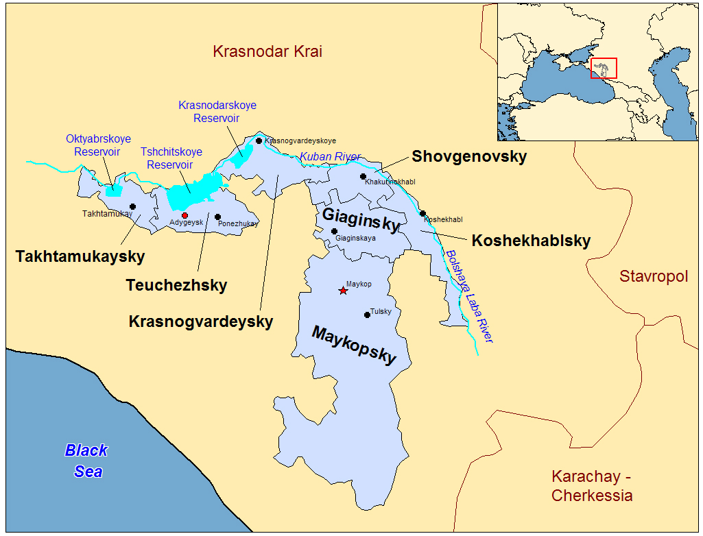
Adyge Republic Map

Called Cherkess by the Soviets, when it was set in the 1920s as an autonomous region for the Adyghe people, more than 60% of the republic’s current 107,000 residents are ethnic Russians. But the Adygejtsy government is headed by an elected official, sensibly called the Head, who by law must be fluent in the Adyghe language.

Notable people who have come from Adygea include professional athletes, a cosmonaut, Sci-Fi novelist Iar Elterrus, and the artist and illustrator Konstantin Vasilyev, who had a minor planet named after him.

The Adyghe are made up of twelve tribes, with two languages, considered dialects by modern linguists. They are among the indigenous people of the Caucasus mountains, but the majority of the modern Adyghe population live in Turkey, Jordan, and Syria, and are Sunni Muslim. Most of the rest reside within the Adygea Republic and are primarily Orthodox Christians, with a minority of Muslims and others not officially religious.
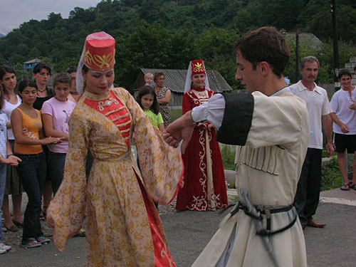
Adyge dancers

Also called the Circassians, the Adyghe suffered from persecution and “ethnic cleansing” throughout their history, when the greater Krasnodar territory was conquered at various times, first by local tribes, then the Kievian Rus, then Byzantine armies, and basically ever afterwards. And the Adyghe have adopted customs from other cultures, just as they have provided some of their own. Hence, they embrace the fashion and spirit of the Slavic Cassocks who were at times their enemy, while also inventing the Cossack’s fabled shashka sword. The word shashka coming from the Adyghe term for “long knife.”

A crossroads of empires, the Adyghe homeland is found within an area that includes the northeastern shore of the Black Sea, and the peninsula situated directly across from the Crimea.

But the Republic of Adygea itself is landlocked within a larger republic, with plains in its northern areas, and mountains in the south. It has no lakes but several large reservoirs. It is one of the poorest Russian republics, but has considerable natural resources, with some 40% of its 2,900 square miles covered large forests, along with undeveloped oil and natural gas reserves.

The Adyghe are also capable farmers, with a deep and fabled history of cultivating fruit and nuts. The oak from the region is prized by Georgian and Russian winemakers, and similar to oak used by French vineyards. And the Adyghe tradition of wine goes back to the deepest recesses of their ancient tribal history, and it is something that even Muslim Adyghe have never given up. Their prehistoric religion was centered on the fruit tree and archeologists have discovered the remnants of Adyghe gardens deep within the wild forests of the Caucuses and Asia Minor, still producing fruit, nuts, and grapes to this day.

This landlocked “island” at the southwest edge of the Russian Federation has a surprising connection to the Isle of Islay, of the Inner Hebrides near the southwest edge of Scotland. Oak trees from a forest in Adygea were made into barrels and seasoned there before being shipped to the Ardbeg distillery, on Islay, where they were used to age single malt whisky that has now been turned into an exclusive, high-priced expression called Kelpie. The result is an impressive and eccentric spirit, even for that maker of exceptionally robust whisky. You can read my exclusive review of Ardbeg Kelpie at 1mansmalt.com.
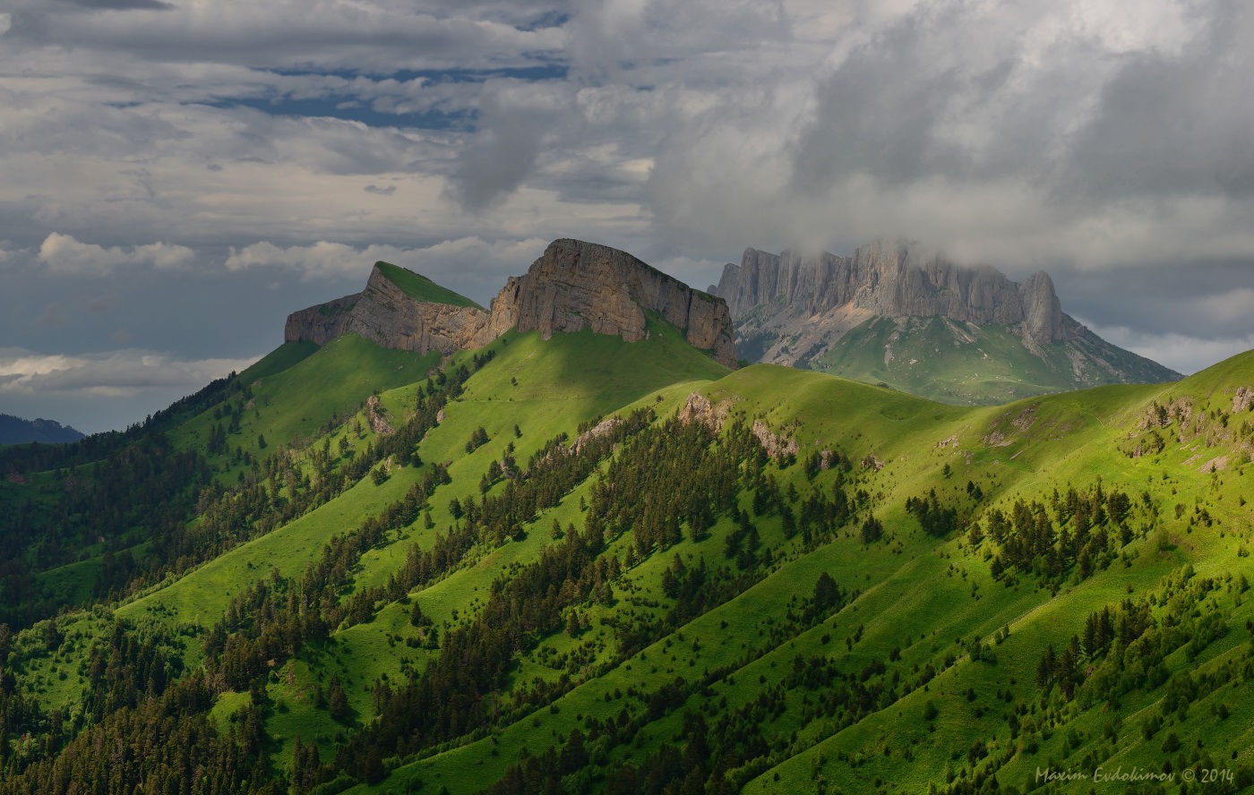
Adygea mountains in the Caucauses


Russian family discovered in remote mountains after decades

Old News: A Russian family lived decades in the remote tiaga wilderness cut off from humanity

This story goes back some years, but it is still amazing, as reported in Smithsonian

Geologists visiting the remote Siberian taiga wilderness in 1978 discovered six members of a family who had fled civilization for religious reasons and survived over 40 years of famine and hardship.

“When (scientist) Pismenskaya asked, “Have you ever eaten bread?” the old man answered: “I have. But they have not. They have never seen it.” At least he was intelligible. The daughters spoke a language distorted by a lifetime of isolation. “When the sisters talked to each other, it sounded like a slow, blurred cooing…”

Two them had never seen a human being other than their parents and brothers.

Read the entire fascinating story HERE

Old News is a new feature at One Man’s World, with interesting facts and tales you may have missed the first time around.

The Somme in All Its Gory – Monday Map

Brilliant Detective Work at 4D Somme

Cartographers use the scarred landscape of France, World War I maps, and satellite imagery to plot the battlefield in stunning detail

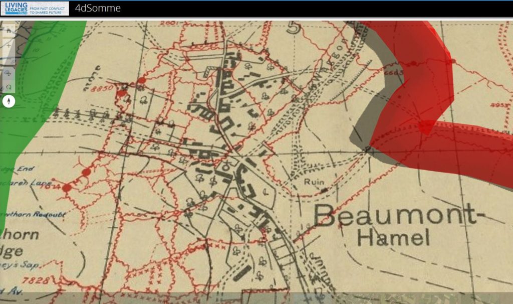
somme-overlay

The website 4D Somme is dedicated to the British units raised in Ireland and Ulster, who saw considerable action during the battle of the Somme, which began on July 1, 1916, and ended nearly 5 months later, on November 18th.

But the overall imagery provided covers the entire battlefield.

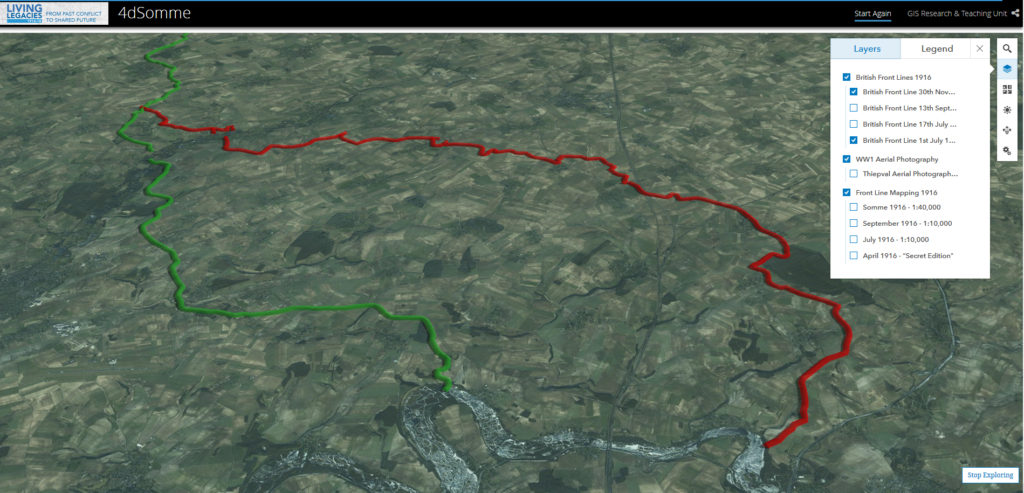
somme-lines-july-november

Above, the British lines at the start and end of the battle.

Hundreds of thousands died to move the front about 7 miles – over one million casualties in total among the British, French, and German forces fated to take part in arguably the most savage and costly battle in human history.

The satellite maps and the overlays taken from actual WWI strategic mapping can be zoomed into down to the individual village, trench, or observation post.

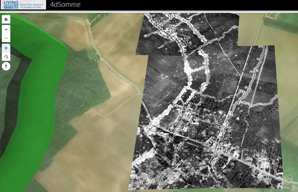
somme-air

Above, actual reconnaissance photographs lined up perfectly where they were actually taken from aircraft similar to those operated by my maternal grandfather, who flew for the American forces father south near the end of the Great War.

While other sites go into greater detail about the people who fought and died along the River Somme in 1916, this site is entirely engrossing and highly recommended.

The 4D Somme full url is

http://queensub.maps.arcgis.com/apps/Cascade/index.html?appid=f0629347d5dc4d6987686f876eec5649