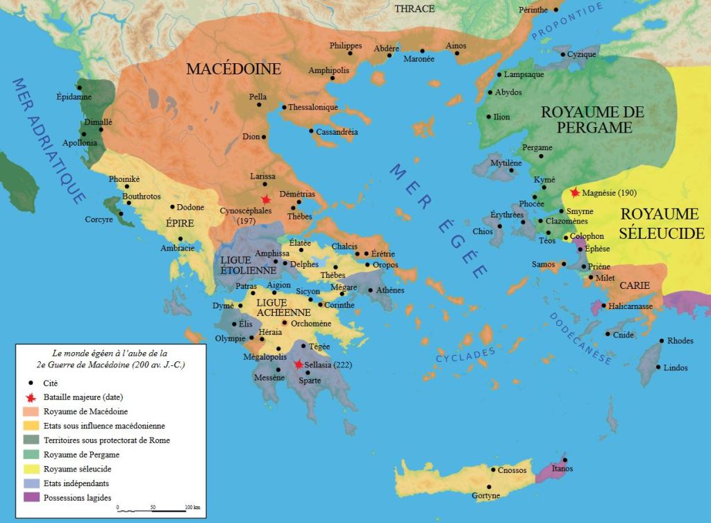
Monday Map – Ancient Macedonia and its principalities, about 100 years after the death of Alexander the Great

In French, but the best map I could find of ancient Macedonia showing Amphipolis, site of the recent revelations at the massive Kasta tomb from the time of Alexander. It is the largest found in Greece.
This homeland of the legendary conqueror Alexander the Great was but a small portion of his empire, which reached all the way to India. This map also shows Rhodes, at the bottom right, from whence came the famous architect Dinocrates, thought to have designed the mega-tomb still being excavated in what is now Northeast Greece.
Also shown is the island of Samos, part of the Greek colonies of Ionia, off the coast of modern day Turkey. It was here that Science was invented by great thinkers like Aristarchus of Samos, who, about about the same time this map represents, offered the earliest known proposition that the planets revolved around the sun and that that the stars were other suns much farther away.
Free from the scrutiny of the authorities far off on the Greek mainland, the scientists of Ionia were free thinkers and developed what we now call the Scientific Method.
Unfortunately, most of their findings and theories were suppressed or disbelieved and the Scientific Method had to wait some centuries more before it was rediscovered, first in Egypt just before the Roman occupation, and then again after the Dark Ages.
For more on the amazing discoveries at the Kasta tomb from ancient Macedonia, please see the following post.