Presidents Day – Monday Map

Presidents Day Map of all the birthplaces

Our Presidents of the United States

The entire bunch were born in but 21 of our 50 States

Fun Facts from the Washington Post

* Ohio is the birthplace of seven presidents, second only to Virginia’s eight. But, Ohio hasn’t elected a president since Warren Harding in 1920. And Harding didn’t even last a full term, dying in 1923. (Random Warren Harding factoid: His size 14 shoes were the largest of any president.)

* Texas’ two native-born presidents may not be who you think they are. Neither George H.W. Bush (Massachusetts) nor George W. Bush (Connecticut) were born in the Lone Star State. The two? Lyndon Johnson and Dwight Eisenhower. (Eisenhower was born in Denison, Texas.)

* Vermont is the smallest state with the biggest presidential punch as the birthplace of both Chester Arthur and Calvin Coolidge.

* California has produced only a single president — and it was Republican Richard Nixon.

The map is sadly out of date.

Polar Vortex on the Way – Monday Map


Polar vortex

A Polar Vortex is actually no laughing matter

Chicago is supposed to be colder than Antarctica by the middle of the week. Mornings of frostbite and lung damage are being issued across Canada and the northern United States.

Polar vortex warn

Apparently warm air from Morocco has made its way to the North Pole causing the upcoming vortex where a southerly Jet Stream poles super-freezing air down into temperate zones. An increase in such vortices fits well within even conservative scientific models of the effect of climate change, which is increasing faster than anyone had ever dared to fear possible.

Please bundle up and bring animals indoors. Please report any stray animals you see two authorities as the serious cold approaches.

Update Jan 31.:  Chicago reached windchill of -52 below zero.

At least four locations have tied or set all-time record lows:

  • Minus 33 degrees Thursday morning in, Moline, Illinois, shattered the all-time record low of minus 28 degrees from Feb. 3, 1996.
  • Minus 30 degrees in Rockford, Illinois, Thursday morning topped their previous record of minus 27 degrees from Jan. 10, 1982.
  • Minus 30 degrees in Cedar Rapids, Iowa, Thursday morning beat the previous all-time record of minus 29 degrees.
  • Minus 43 degrees northwest of Mather, Wisconsin, Wednesday tied the all-time low at that location in records dating to 1903.

Monday Map – 1965 Selma March

The Selma March Historic Byway

Martin Luther King Day

On March 7th, 1965, the historic Selma to Montgomery March took place. Hundreds of marched in support of civil rights for all Americans, and expressly for the rights of African-Americans subjected to institutionalized segregation and bigotry.
The march was blocked by Alabama state troopers and aborted. A second march on March 18th was cancelled due to a court order.
Over 25,000 gathered on March 21st, and with the help of federal troops and law enforcement, they completed the 54 mile trek to the state capital in Montgomery.
While the reality of who Doctor King was and what is actual legacy has been. There is no question that assassinated leader stands today as a martyr to social justice in America. And the Selma March remains one of the most tangible symbols of the Civil Rights movement of the 1950s and 1960s.
The Voting Rights Act of 1965 was introduced in Congress during the Selma March, and once passed became among the most far-reaching pieces of civil rights legislation in U.S. history.
Selma http://www.fhwa.dot.gov/byways/byways/2050/maps

The route of the Selma March is now one of the Federal Highway Administration’s America’s Byways and also a National Park Service Historic Trail that is currently closed due to the ongoing attempted Right Wing coups that has shut down the Federal Government.

Selma http://www.nps.gov/common/commonspot/customcf/apps/maps/showmap.cfm?alphacode=semo&parkname=Selma%20To%20Montgomery
A period map from the time: HERE
More Monday Maps: HERE

Sumatra – Monday Map

When Marco Polo visited the island Sumatra in 1292 he recorded its name as Samarcha.

Much of the population had already converted to Islam by that time. But nearly three-hundred years earlier the “King of the Land of Sumatra” (Haji Sumatrabhumi) had sent an envoy to China in 1017. And long before that it was known as the Land of Gold, because of the mines in its highlands.

Sumatra 1588 map onemanz.com

Map from 1588

And before international jetliners, it was about as far away as one could go, the very edge of the earth, and as exotic an alien world as ever visited by Westerners outside of science fiction.

Below is a section of a much larger map of South East Asia from 1710, with an example of the wonderful detail.

Sumatra 1710 section onemanz.comSumatra 1710 map detail onemanz.com

Until well into the twentieth century most of the Sumatran interior was dense rain forest jungles. Over 50% of its natural forests have been removed for farming and human population requirements. The result is the serious endangerment of its many native species, like the Sumatran tiger and the newly discovered the Tapanuli Orangutan, the first new member of the Great Apes in almost a century.

Normandy, June 1944 – Monday Map

Complete with relief photos and elevation tables, the actual maps from the Normandy Invasion still inspire awe.

Classified as “Bigot,” the highest top secret security level possible, a very few persons even knew of the existence of this and other maps prepared for the assault on Hitler’s Fortress Europe.

Half of Omaha Beach

omaha_beach_east_f_1944_ Normandy2

omaha_beach_east_b_1944 Normandy

Source: Wikipedia

June Gloom and a Full Moon

June has come with gloom under low, unseasonably cool skies over New York City, mirroring the climate in Northwest Europe at the opening of the most monumental June in human history. [Now June 6, 2017, and it is 56 degrees and with a intermittent sea mist rain that makes this 73rd anniversary’s weather all the more like the 6th of June in Normandy in 1944, than when this was originally posted in 2015.]

The weather was so bad in the spring of 1944 that D-Day was postponed at the last minute, for 24 hours. So the first courageous airborne troops dropped from the sky a few minutes after midnight on June 6, to begin operations prior to the full scale assault that slammed into five beaches, as dawn lit the Normandy coastline west of Caen.

These maps give some indication of the enormity of the invasion, and the amount of detailed planning that went into it.

Some are taken from painstaking copies of original Bigot maps created for the D-Day landings, and available for sale at Alan Godfrey Reproductions.

 The Full Invasion Area

Allied_Invasion_Force_Normandy

Half of Utah Beach

Utah_Beach_Map_Front_A Normandy

American Naval Operations (Operation Neptune)

D-Day navy map Normandy

British Empire Operations

Normandy Invasion Map

Canadian Assault on Juno Beach

Canadian D Day Landings Normandy

British Main Assault at Sword Beach

Sword Beach Normandy

Detail from Bigot map of Sword Operations (English and Free French Commandos)

ouistreham Normandy map

Detail of British Bigot Map Legends

Map Legend Normandy

Other Reading:

Britannica’s D-Day site was created years ago, so it has some bad links, but it is full of interesting oral histories by veterans, as well as detailed charts and maps, and other information of interest.

http://kids.britannica.com/dday/browse?browseId=237176

U.S. Army official report on the action at and around Omaha Beach, 6 June 1944. This was prepared and provided to veterans at the 50th Anniversary commemoration in 1994, and based closely on the official report by the War Department, 20 September 1945

http://www.history.army.mil/books/wwii/100-11/100-11.HTM

South-East Islay Skerries – Monday Map

A hauntingly beautiful seascape, the skerries along the southeastern coast of the Isle of Islay are now a nature preserve

Home to charming marine life and at least one species of scary skerry folklore

click photos to enlarge

Skerry is the name given to any of the countless little islets that dot the Scottish seacoast, from the Kintyre peninsula at the nation’s southwest corner, to the subarctic Shetland Islands far to the north. The Isle of Islay, the southernmost main island of the Inner Hebrides, just west of Kintyre, is surrounded by a necklace of skeeries ranging from small islands filled with nesting birds, to minuscule teeth of jagged rock barely rising from the surrounding shallow seas that are choked with thick kelp forests and teaming with aquatic creatures.

S E Islay Skerries

They were also known to be the haunt of kelpies, shapeshifting water spirits of ancient Pictish folklore, who often came ashore in the physical guise of a horse. Those unfortunate enough to encounter one were beguiled by the promise of a free ride on a beautiful mount, only to be unable to dismount before the kelpie returned to the depths to drown and devour them.

kelpie water horse spirit skerries

Not exactly Disney’s Little Mermaid.

Before the advent of modern conveniences, villages along Islay’s stormy southeast coast depended upon their local skeeries as a source of food, from seabird eggs, to shellfish, to larger marine life. All such traditions came to an end in 2005, when the South-East Islay skeeries became an official protected Area of Special Conservation.

Scotland Islay Skerries ASC

South-East Islay Skerries lighthouse

click to enlarge

The Kintyre Peninsula is seen in the distance of this photo, miles beyond the lighthouse that stands on a small skerry at about the midway way point of the South-East Islay Skerries SAC.

While there are five other locations on Islay designated as protection areas for birds, the South-East Islay Skeeries received their specific designation as a marine ASC due to an important colony of some 600 harbor seals (Phoca vitulina) that rely on the area for pupping, molting, and hauling-out areas, where seals leave the water for long periods of time to socialize, usually segregated by sex and age group.

seals-loch-an-tsailein-islay-skerries

Some 80% of the SAC is made up of marine areas and sea inlets, while 18% is consists of the skeeries, as well as sea cliffs and the rocky shingle along the main island. The remaining 2% is salt marshes and salt pastures. The topography includes a series of underwater ridges, which provide the seals unique opportunities for hunting and sheltering from the strong currents in that location.

On the coastline near the southern end of the South-East Islay Skerries SAC is the Ardbeg distillery. One of nine active single malt whisky distilleries on Islay, several being known for producing the most robust single malts in the world, Ardbeg makes the peatiest, smokiest single malt Scotch whisky available today.

In 2017, Ardbeg released a special expression of their whisky named Kelpie, in honor of the local kelpie legends and the fact it has a particularly volatile and maritime character, not for the timid tippler of landlubber libations. And you can read an exclusive feature article on Ardbeg Kelpie at our sister site One Man’s Malt.

ddArdbeg Skerries

photos in this post are by Armin Grewe. Check out his marvelous photoblog

http://www.islay.org.uk/

And his text and photo blog about one of the coolest places Planet Earth

http://new.islayblog.com/

Adygea Republic- Monday Map

The Republic of Adygea is virtually unknown in the West

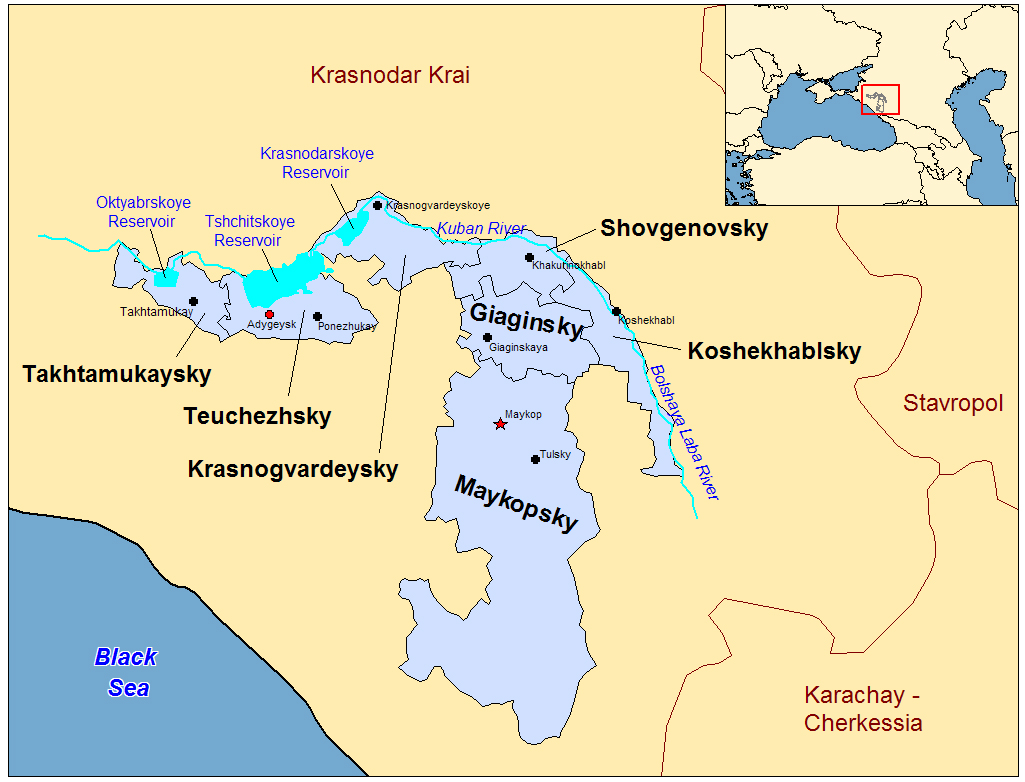
Located within Krasnodar Krai, at the extreme southwest tip of the Russian Federation, near the Black Sea

Adyge Republic Map

Called Cherkess by the Soviets, when it was set in the 1920s as an autonomous region for the Adyghe people, more than 60% of the republic’s current 107,000 residents are ethnic Russians. But the Adygejtsy government is headed by an elected official, sensibly called the Head, who by law must be fluent in the Adyghe language.

Notable people who have come from Adygea include professional athletes, a cosmonaut, Sci-Fi novelist Iar Elterrus, and the artist and illustrator Konstantin Vasilyev, who had a minor planet named after him.

The Adyghe are made up of twelve tribes, with two languages, considered dialects by modern linguists. They are among the indigenous people of the Caucasus mountains, but the majority of the modern Adyghe population live in Turkey, Jordan, and Syria, and are Sunni Muslim. Most of the rest reside within the Adygea Republic and are primarily Orthodox Christians, with a minority of Muslims and others not officially religious.

Adyge dancers

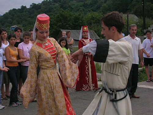
Also called the Circassians, the Adyghe suffered from persecution and “ethnic cleansing” throughout their history, when the greater Krasnodar territory was conquered at various times, first by local tribes, then the Kievian Rus, then Byzantine armies, and basically ever afterwards. And the Adyghe have adopted customs from other cultures, just as they have provided some of their own. Hence, they embrace the fashion and spirit of the Slavic Cassocks who were at times their enemy, while also inventing the Cossack’s fabled shashka sword. The word shashka coming from the Adyghe term for “long knife.”

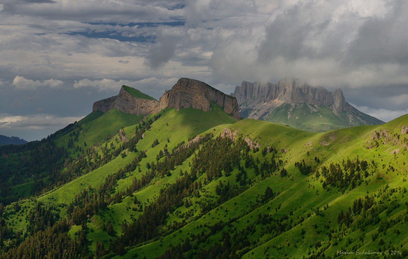
A crossroads of empires, the Adyghe homeland is found within an area that includes the northeastern shore of the Black Sea, and the peninsula situated directly across from the Crimea.

But the Republic of Adygea itself is landlocked within a larger republic, with plains in its northern areas, and mountains in the south. It has no lakes but several large reservoirs. It is one of the poorest Russian republics, but has considerable natural resources, with some 40% of its 2,900 square miles covered large forests, along with undeveloped oil and natural gas reserves.

The Adyghe are also capable farmers, with a deep and fabled history of cultivating fruit and nuts. The oak from the region is prized by Georgian and Russian winemakers, and similar to oak used by French vineyards. And the Adyghe tradition of wine goes back to the deepest recesses of their ancient tribal history, and it is something that even Muslim Adyghe have never given up. Their prehistoric religion was centered on the fruit tree and archeologists have discovered the remnants of Adyghe gardens deep within the wild forests of the Caucuses and Asia Minor, still producing fruit, nuts, and grapes to this day.

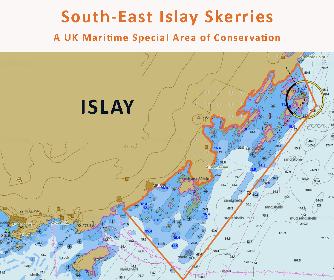
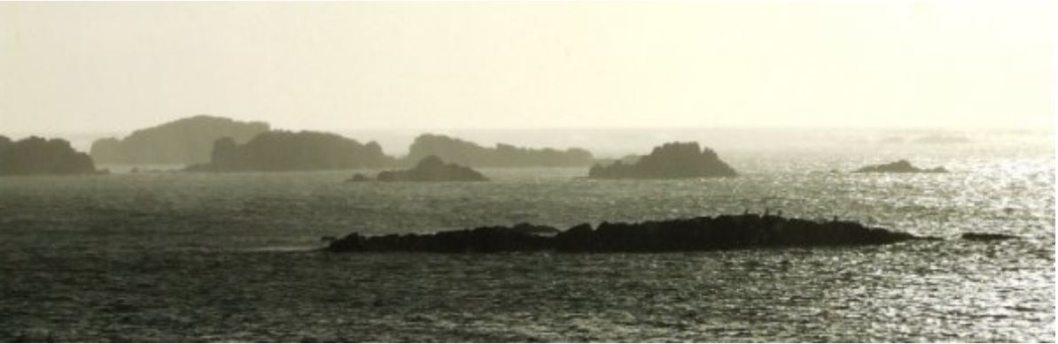
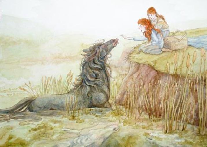
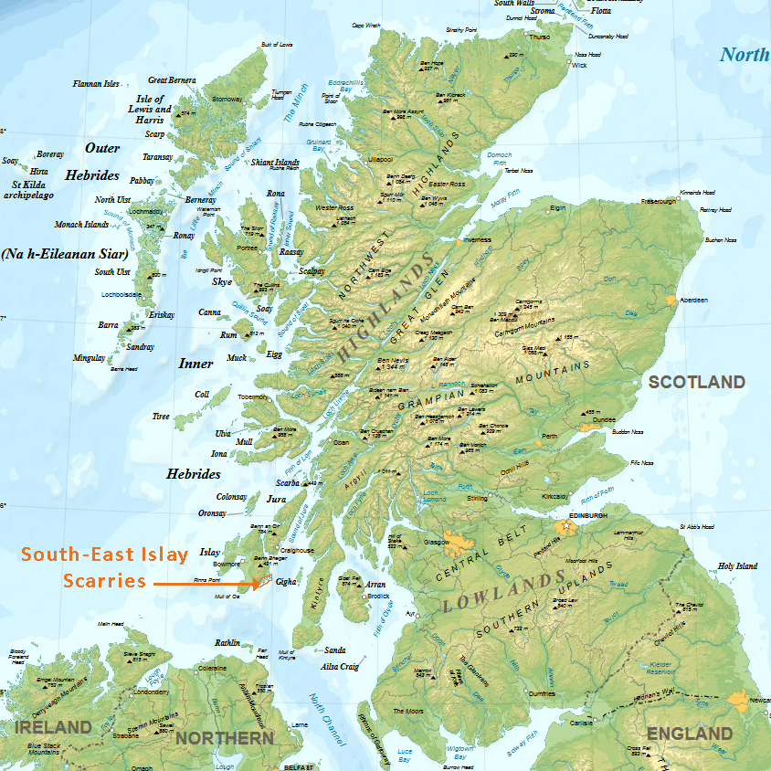
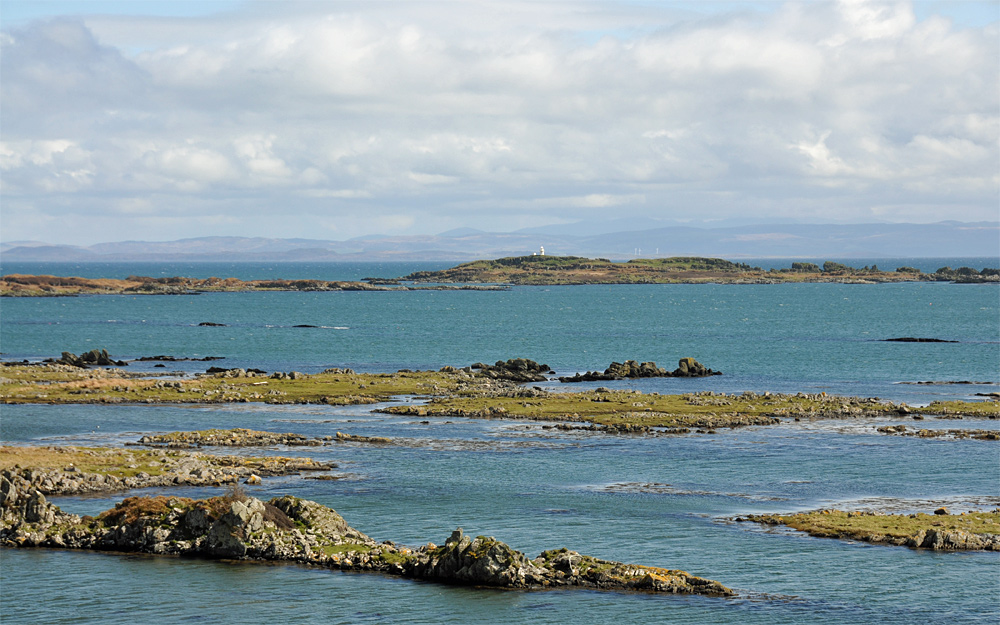
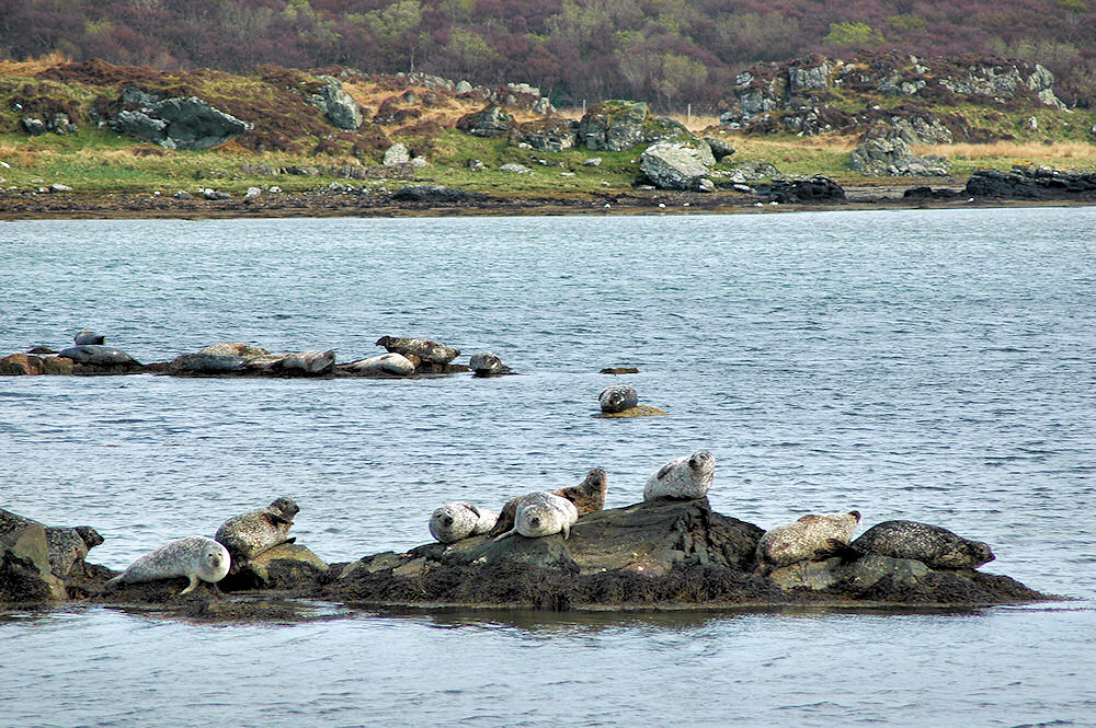
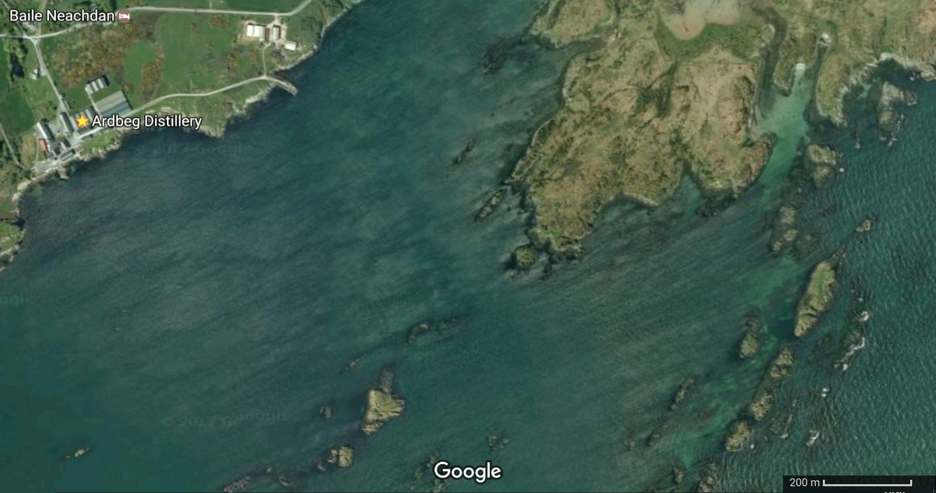
This landlocked “island” at the southwest edge of the Russian Federation has a surprising connection to the Isle of Islay, of the Inner Hebrides near the southwest edge of Scotland. Oak trees from a forest in Adygea were made into barrels and seasoned there before being shipped to the Ardbeg distillery, on Islay, where they were used to age single malt whisky that has now been turned into an exclusive, high-priced expression called Kelpie. The result is an impressive and eccentric spirit, even for that maker of exceptionally robust whisky. You can read my exclusive review of Ardbeg Kelpie at 1mansmalt.com.

Adygea mountains in the Caucauses


The Sierra Cacachilas Mountains of Baja Sur, Mexico – Monday Map

Haunt of Hikers, Divers, and the Giant Spider Califorctenus of the Cacachilas

Situated between La Paz and El Sargento in Southern Baja

Baja Sur Sierra Cacachilas detail map

Before the 2017 announcement that a new genus of giant wandering spider was discovered there in an abandoned mine shaft, I had never heard of the Cacachilas Mountains, located in a relatively out of the way corner of Baja California Sur, the second-least populated state in Mexico.

Baja Sur Sierra Cacachilas satellite map

As it turns out, the nearby sea coast is a popular place for scuba divers. And the Cacachilas themselves offer an expansive sunny landscape for hikers and burro riders who want to get away from it all and commune with some the wildlife. But don’t worry, the spider isn’t that venomous. And since it had gone undetected by science all these many centuries, it is safe to say you will likely never see one outside of a zoo, or perhaps an abandoned mine shaft.

sierra-cacachilas-mexico


Related Reading:

https://www.ranchocacachilas.com/home/

The Somme in All Its Gory – Monday Map

Brilliant Detective Work at 4D Somme

Cartographers use the scarred landscape of France, World War I maps, and satellite imagery to plot the battlefield in stunning detail

somme-overlay

The website 4D Somme is dedicated to the British units raised in Ireland and Ulster, who saw considerable action during the battle of the Somme, which began on July 1, 1916, and ended nearly 5 months later, on November 18th.

But the overall imagery provided covers the entire battlefield.

somme-lines-july-november

Above, the British lines at the start and end of the battle.

Hundreds of thousands died to move the front about 7 miles – over one million casualties in total among the British, French, and German forces fated to take part in arguably the most savage and costly battle in human history.

The satellite maps and the overlays taken from actual WWI strategic mapping can be zoomed into down to the individual village, trench, or observation post.

somme-air

Above, actual reconnaissance photographs lined up perfectly where they were actually taken from aircraft similar to those operated by my maternal grandfather, who flew for the American forces father south near the end of the Great War.

While other sites go into greater detail about the people who fought and died along the River Somme in 1916, this site is entirely engrossing and highly recommended.

The 4D Somme full url is

http://queensub.maps.arcgis.com/apps/Cascade/index.html?appid=f0629347d5dc4d6987686f876eec5649